


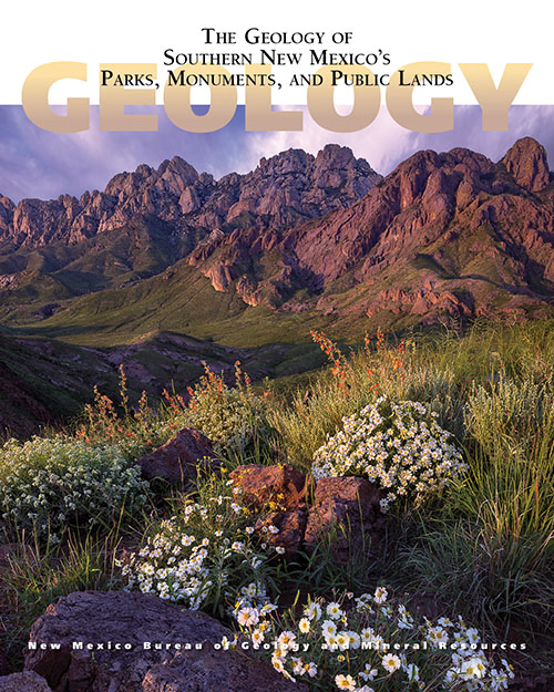
The Geology of Southern New Mexico's Parks, Monuments, and Public Lands
We are a research and service division of:
Edited by: Peter A. Scholle, Dana S. Ulmer-Scholle, Steven M. Cather, and Shari A. Kelley
2020
Southern New Mexico has a wonderful combination of spectacular scenery and abundant public lands. The state's diverse and interesting geology is reflected in its numerous National and State parks and monuments (including Carlsbad Caverns and White Sands) as well as other publicly accessible lands, which range in size from the multi-million acre Gila wilderness to small roadside turnoffs and picnic areas. This book, crafted by geoscientists but written for the interested public, provides an understanding of the exposed rock units that record more than 1.7 billion years of geologic and biologic changes in this region. With nearly 400 full-color photographs, geologic maps, and illustrations, this book illuminates not just the rocks and fossils of southern New Mexico, but also archaeological/historical sites as well as the water, mineral, and energy resources of the region.
404 pages, full color 8" x 10" paperback with sewn binding.
ISBN: 978-1-883905-48-4
$29.95
Buy
Now
Download
Free sample chapter — White Sands (12 MB PDF)
The book is the second of two volumes on the geology of New Mexico's public lands – the first, published in 2010, dealt with the northern half of the state and, correspondingly, this volume deals exclusively with the southern regions. Nearly 35% of New Mexico's land is Federally owned (a relatively low percentage when compared with the 47% Federal owner- ship of the 11 coterminous western states including New Mexico). In that context, however, it should also be noted that the percentage of Federal lands in southern New Mexico is far higher than in northern New Mexico. An additional 11% of New Mexico's area is State owned and administered. Although not all State or Federal lands are available for public access, we nonetheless had to make difficult choices on which of the enormous reserved land areas to include in this book. All national parks and national monuments (under either National Park Service or Bureau of Land Management administra- tion) are included in this book. All state parks, and many state monuments and historical sites also are covered. Geologically important national forest areas, wilderness and wilderness study areas, and scenic byways are included as well and in this volume, unlike the prior one, we also feature a few additional areas of special geological interest that have public access. Those include areas owned or operated by the Nature Conservancy, the National Radio Astronomy Observatory (Very Large Array) and Freeport-McMoRan. On the other hand, we excluded many geologically interesting areas that have little or no public access, especially the extensive military reservations.
Contents
Part 1: The Colorado Plateau/Mogollon Slope
- Quemado Lake Recreation Area
- Monument Rock and the Sawtooth Mountains
- The Very Large Array and the Plains of San Agustin
- Datil Well Recreation Area Campground
Part 2: The Mogollon-Datil Volcanic Field
- Gila Cliff Dwellings National Monument
- The Gila Wilderness
- Catwalk National Recreation Trail
- Gila Riparian Preserve
- Mimbres River Preserve
- Chino Mine Overlook
- Gila Lower Box Canyon
Part 3: The Basin and Range
- Fort Cummings National Historic Site
- City of Rocks State Park
- Rockhound State Park and Spring Canyon Recreation Area
- Pancho Villa State Park
- Big Hatchet Mountains Wilderness Study Area
- Geronimo Trail in the Southern Peloncillo Mountains
Part 4: The Rio Grande Rift
- Sevilleta National Wildlife Refuge
- San Lorenzo Canyon Recreation Area
- Quebradas Back Country Byway
- Magdalena and San Mateo Mountains
- Mineral Museum
- Bosque del Apache National Wildlife Refuge
- Fort Craig and El Camino Real Trail
- Valley of Fires Recreation Area
- Capitan Mountain Wilderness and Smokey Bear Historical Park
- Fort Stanton-Snowy River Cave National Conservation Area
- Lincoln State Monument
- The Lincoln Highlands of South-Central New Mexico
- White Mountain Wilderness
- Three Rivers Petroglyph Site
- Tunnel Vista Observation Site and Fresnal Canyon
- White Sands National Park (free sample chapter)
- Oliver Lee Memorial State Park
- Elephant Butte Lake State Park
- Caballo Lake and Percha Dam State Parks
- Lake Valley Back Country Byway
- Fort Seldon State Monument and Leasburg Dam State Park
- Mesilla Valley Bosque State Park
- Organ Mountains–Desert Peaks National Monument
- Prehistoric Trackways National Monument
- Robledo Mountains and Broad Canyon Trail System
- Kilbourne Hole Volcanic Crater National Natural Landmark
Part 5: The Permian Basin
- Carlsbad Caverns National Park
- Sitting Bull Falls Recreation Area
- Guadalupe Back Country Byway
- Living Desert Zoo and Gardens State Park
- Brantley Lake State Park
- Bottomless Lakes State Park
- Bitter Lake National Wildlife Refuge
- Mescalero Sands North Dune Off-Highway Area
Part 6: The Southern Great Plains
- Manzano Mountains State Park
- Salinas Pueblo Missions National Monument
- Sumner Lake, Bosque Redondo, and Fort Sumner
- Oasis State Park
- Blackwater Draw National Archaeological Site
Awards

2020 Southwest Book Design & Production Award Winner for Scholarly & Technical