


Open-file Geologic Map - 2
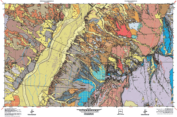
Geology of the Bernalillo and Placitas quadrangles, Sandoval County, New Mexico
Sean D. Connell, Steve M. Cather, Bradley Ilg, Karl E. Karlstrom, Barbara Menne, Mark Picha, Chris Andronicos, Adam S. Read, Paul W. Bauer, and Peggy S. Johnson
1995
(last revised: 17-February-2000)
scale 1 : 24,000
https://doi.org/10.58799/OF-GM-2
Note:
This map combines two quadrangles: OFGM-16: Bernalillo and OFGM-2: Placitas, and has been incorporated into a larger regional map:
GM-78 — Geologic map of the Albuquerque-Rio Rancho metropolitan area and vicinity, Bernalillo and Sandoval Counties, New Mexico, Connell, Sean D., 2008, Scale 1:50,000, ISBN: 9781883905262.
Plates:
Plate numbers ending in "a" are alternative layouts that are formatted for 54"x45" paper. All the other plates are formatted for 50"x36" paper. All content is present with the combination of either Plates 1,2, & 3 or Plates 1a & 2a.
Plate 1 & 1a: Geologic Map (1a also includes cross-section A-A')
Plate 2 & 2a: Geologic Cross-sections (2a also includes Unit Descriptions and Correllation Chart)
Plate 3: Unit Descriptions and Correllation Chart
Downloads
| File Name | Size | Last Modified |
|---|---|---|
| BernalilloPlacitasPlate1.pdf | 7.94 MB | 08/01/2003 04:05:00 PM |
| BernalilloPlacitasPlate1a.pdf | 6.74 MB | 08/01/2003 04:05:00 PM |
| BernalilloPlacitasPlate2.pdf | 3.75 MB | 08/01/2003 04:05:00 PM |
| BernalilloPlacitasPlate2a.pdf | 5.27 MB | 08/01/2003 04:05:00 PM |
| BernalilloPlacitasPlate3.pdf | 522 KB | 08/01/2003 04:05:00 PM |
| MoreInfo.txt | 1 KB | 02/11/2021 04:01:48 PM |
| OFGM-2-16_BernalilloPlacitas_Plates1-3.pdf | 12.00 MB | 02/11/2021 04:04:51 PM |
| 50x36: | ||
| OF-GM-2-16_BernalilloPlacitasPlate1.pdf | 7.92 MB | 02/11/2021 10:10:16 AM |
| OF-GM-2-16_BernalilloPlacitasPlate2.pdf | 3.75 MB | 02/11/2021 10:11:04 AM |
| OF-GM-2-16_BernalilloPlacitasPlate3.pdf | 522 KB | 02/11/2021 10:12:07 AM |
| 54x45: | ||
| OF-GM-2-16_BernalilloPlacitasPlate1a.pdf | 6.72 MB | 02/11/2021 10:10:46 AM |
| OF-GM-2-16_BernalilloPlacitasPlate2a.pdf | 5.27 MB | 02/11/2021 10:11:33 AM |
| GISdata: | ||
| OFGM-02_Placitas.zip | 12.66 MB | 08/01/2003 04:05:21 PM |
| OFGM-16_Bernalillo.zip | 7.94 MB | 08/01/2003 04:05:21 PM |
| Reports: | ||
| OFGM-02_PlacitasReport.pdf | 236 KB | 02/11/2021 04:03:52 PM |
| OFGM-16_BernalilloReport.pdf | 321 KB | 02/11/2021 04:04:20 PM |
Notes:
Geologic mapping of this and other 7½-minute quadrangles in New Mexico is being cooperatively funded by the USGS through the STATEMAP program and with matching funds from the Bureau. For a list of quadrangles in this series, please visit the Open-file Geologic Map (OF-GM) page or try our search page for geologic maps of any series.
These maps are open-filed as they become available. Initially, maps are posted as PDF files of scans of the hand-drawn linework, and later as full color maps and GIS products. These files can be downloaded for free or may be purchased on CD-ROM.
These maps are subject to frequent revisions and may be unavailable when being revised. Map Reference dates show the time of initial compilation; Map Revision dates, when given, indicate the most current version of the map; Last Modified dates for files may not accurately reflect the time the map was last revised.
Please direct comments or requests regarding these maps to either the map authors or the Geologic Mapping Program Manager.