


Circular 209
We are a research and service division of:
NMBGMR | PRRC | GO-TECH
Overview | ArcView Project | ArcExplorer Project | Pooltools | PDFs | Morrow Play
This is the documentation for Circular 209
which is available on CDROM
which is available on CDROM
New Mexico Oil & Gas Pools
Adam Read, Ron Broadhead, Annabelle Lopez
Elizabeth Fleming, and Jim Watrous
New Mexico Bureau of Mines & Mineral Resources
A division of NM Tech
With an additional special emphasis on:
The Morrow Play
Adam Rewis1 and Brian S. Brister2
2New Mexico Bureau of Mines & Mineral Resources (former staff member)
1New Mexico Institute of Mining & Technology--Computer Science Department (former graduate student)
9/17/2000
These projects in cooperation with:
The Petroleum Technology Transfer Council's
SW Regional Lead Organization
and
Staff at the New Mexico Petroleum Recovery Research Center


Background
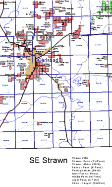
In New Mexico, oil and gas pool names have both a geographic and a stratigraphic component (e.g. Bisti Gallup). The first part of the pool name is the field name and is usually derived from the geographic location of the the pool (e.g. Bisti). The second part of the pool name is the stratigraphic name and is derived from the stratigraphic unit that produces the oil or gas (e.g. Gallup). Because of this system of pool nomenclature, pool boundaries may overlap where production in an area is obtained from more than one stratigraphic unit. Therefore, the oil and gas pool maps are organized stratigraphically. There are currently 21 maps in NW New Mexico and 24 maps in SE New Mexico. Oil and gas pool boundaries indicated on these maps are the legal boundaries of the pools as provided by the New Mexico Oil Conservation Division.
Click here for an image of the extent of oil and gas pools in NM.
Legal Notice:
Neither the New Mexico Bureau of Mines & Mineral Resources or any person or subcontractor acting on the behalf of this organization:
- Makes any warranty or representation, express or implied, with respect to accuracy, completeness, or usefulness of the information contained on these maps; nor
- Assumes any liability with respect to the use of any information presented on these maps
Software Overview
The boundaries of oil and gas pools in New Mexico are plotted on a section-township-range grid as a GIS project (Geographic Information System). In order to view these maps you will need to have ArcExplorer (freeware from ESRI and also included with this package--see installation notes below) or ArcView 3.1 or higher (a Desktop ESRI GIS software package). For those not capable of running these GIS applications or those that want printed output, the maps may also be viewed as PDF files (requires Adobe Acrobat version 4--freeware and also included in this package). This CD-ROM will allow Windows 9x/NT/2000 users full access to the data for this GIS project and will make quick access possible for those with only slow modem connections to the Internet. Production data is also available online using a data query form at the NM Petroleum Recovery Research Center's GOTECH site.
System Requirements/Recommendations
PC (recommended) For the entire software package including GIS Projects:
- PC running windows 95/98/NT/2000, hard disk space: at least 4 MB for ArcExplorer, 30 MB for Adobe Acrobat, and 300 MB if map data is copied to a local hard disk, ~ 64MB RAM, ~ 200MHz processor or faster. ArcView v.3.1 or greater will provide full functionality but is not required to view the maps. If you have a Windows 3.1 system, you will only be able to view the PDF files.
UNIX (note: The ArcExplorer project is not accessible by UNIX platforms.)
- ArcView 3.1 or greater is required for full functionality. Unfortunately, installation of the ArcView Project onto a UNIX system will be somewhat complicated (see below) and the ArcView Hotlinks to production data are Windows specific. Any UNIX variant that can run Adobe Acrobat version 4 will be able to browse the PDF versions of the maps.
Macintosh (note you will likely only be able to view the PDF files--ArcExplorer is not available and Mac ArcView not tested):
- System 9, 128 MB RAM, and G3 or faster processor recommended (but any configuration with sufficient RAM that will run Acrobat v4 should work), 125 MB hard disk space for PDF files.
Installing the software
After you install the appropriate reader software for your system, you can either access the poolmap data directly from the CD-ROM, or you can install the software on a hard drive (this will provide faster access but will require up to ~260 MB of disk space).
For every system: You can open the PDF files directly from the CD-ROM, or you can copy the entire /PDFs folder to your hard disk for faster access. Use your web browser to open the file: pdf-maps.htm if you are using the CD-ROM, or pdf-8-3s.htm if you have copied the files to your system.
- If you have a Windows 3.1 system, install Adobe Acrobat (Adobe Acrobat Reader for a Windows 3.1 system is included with this package (look in the folder: /Programs/Acrobat/Win31) or Acrobat Reader for your system can be downloaded from http://www.adobe.com/products/acrobat/readermain.html). Open either of the HTML files mentioned above with your web browser to browse the PDF files.
- If you have a Windows 9x/NT/2000 system, you can install the poolmaps software and data on your hard disk. Use the menus provided when the CD-ROM is inserted into a Windows computer (run the 'Autorun.exe' file if this function is disabled on your system). If you choose 'copy CD-ROM to disk' from the install menu, a program Poolmaps-Menu.exe will be included in the directory you specify and will provide easy access maps and data. You could also manually execute either of the self extracting zip files copy-CDROM.exe (requires ~260 Mb of disk space) or copy-PDFs.exe (requires ~121 Mb of disk space) to copy data to the directory of your choice. Follow the instructions below for opening and using the maps and data.
- If you have a, UNIX system,you will need to copy the CD-ROM to a Windows computer and then use FTP to install the data on the UNIX system (this procedure is necessary because of the CD format and filename convention incompatibilities). Before you open the ArcView project, you must convert the project file from DOS format to UNIX format (dos2unix AV-NM-poolmaps.apr NM-poolmaps.apr). Adobe Acrobat for your UNIX variant can be downloaded from http://www.adobe.com/products/acrobat/readermain.html. Open either of the HTML files mentioned above with your web browser to browse the PDF files.
- If you have a Macintosh, install Adobe Acrobat Reader v. 4 which is included with this package for a Power PC system (look in the folder: /Programs/Acrobat/MacOS) or the current version for your system can be downloaded from http://www.adobe.com/products/acrobat/readermain.html). Open either of the HTML files mentioned above with your web browser to browse the PDF files.
Additional data on these maps
- Geographic reference (these public domain data were obtained from the RGIS Clearinghouse):
- Counties
- Townships
- Section lines
- Highways
- Surface water
- Towns
- Metro Areas
- Subsurface reference
- Oil and gas well spots (this data was provided by the NM Petroleum Recovery Research Center--PRRC)
- Production data
The ArcView project provides Internet hyperlinks from individual oil and/or gas wells and sections to current production data from the GO-TECH PTTC website maintained by the PRRC.- (Note: These production data are obtained from the state's ONGARD system and generally include only those wells that are currently productive or recently productive. ArcExplorer users will need to enter well or section information into the GO-TECH PTTC query form manually.
- Production data
- Water well spots (this USGS data was also obtained from the RGIS Clearinghouse)
- Cuttings on file at New Mexico Bureau of Geology & Mineral Resources Subsurface Library (well spots are in the center of the section they lie in and are not accurate because latitude and longitude information is not available -- also, those wells within grant boundaries are not shown).
- Core on file at New Mexico Bureau of Geology & Mineral Resources Subsurface Library.
- Oil and gas well spots (this data was provided by the NM Petroleum Recovery Research Center--PRRC)
Note that revision of these maps is an ongoing project of the Bureau.
The ArcExplorer project (AE-NM-Poolmaps.aep)
Install the ArcExplorer v. 1.1 software (double click on the file: /Programs/aeclient.exe in the windows explorer and following the prompts or download from ESRI -- (Version 2 is available, but requires more disk space, is slower, and the new features are unnecessary for these projects. Also note that the Java version (3) is incompatible with the projects provided).
Start ArcExplorer and open the file 'AE-NM-Poolmaps.aep'. A map of New Mexico will appear showing the extent of oil and gas pools. Production data is not directly accessible from ArcExplorer.
Detailed instructions on how to use the ArcExplorer project are presented on a separate page or consult the online help provided with ArcExplorer..
The ArcView project (AV-NM-poolmaps.apr)
Using the ArcView project provided with this package will provide the most functionality and flexibility for the user. However, ArcView (while less expensive than the more powerful ArcInfo GIS ) will still require what will be for most a considerable financial investment as well as time to learn to use the software. Some basic instruction on using ArcView, working with the Poolmaps project, and using the custom buttons and tools is presented on a separate page.
Production data can be accessed directly from from the Internet within the ArcView project using the 'production' ![]() .tool. (Note: the scripts that create the production tool are included in the NM-poolmaps.apr project and don't require the pooltools.avx extension).
.tool. (Note: the scripts that create the production tool are included in the NM-poolmaps.apr project and don't require the pooltools.avx extension).
Pooltools (used for editing the poolmaps)
Several other custom tools used to create the poolmaps can be loaded into Arcview with the pooltools extension. Documentation for these tools is presented on a separate webpage.
The Morrow Play Data
Additional data is available on the Morrow pools from either the ArcExplorer or ArcView projects. Make the 'Morrow pools' and/or 'Morrow wells' theme visible and active (you can use the 'Morrow' ![]() tool to do this automatically) and use the 'identify'
tool to do this automatically) and use the 'identify' ![]() tool to see additional information about the pool. See the Morrow Play page for a complete discussion of the supplemental Morrow data available in this package.
tool to see additional information about the pool. See the Morrow Play page for a complete discussion of the supplemental Morrow data available in this package.
PDF versions
Each of the poolmaps are available as PDF files (from the CD-ROM only). Adobe Acrobat v.4 is needed to view these files. It is available free from Adobe and is also included with this package in the '/Programs/Acrobat/' folder for Windows 3.1, Windows 9x/NT/2000, and Macintosh.
For additional information, visit our Oil & Gas program page.