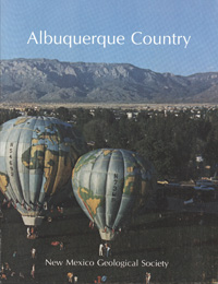
New Mexico Geological Society
Fall Field Conference Guidebook - 33
Albuquerque Country II

Jeffrey A. Grambling, Steven G. Wells and Jonathan F. Callender, eds, 1982, 370 pages.
After 21 years (see Guidebook 12), the fall field conference returns to the Albuquerque area, the largest urban center in New Mexico. Since 1961, Albuquerque's population has mushroomed from about 200,000 to well over 370,000. Albuquerque and its surrounding area are characterized by a multifaceted geologic setting. Such geologic variety results from the fact that the Albuquerque area lies at the juncture of four major physiographic provinces: Basin and Range, Colorado Plateau, Great Plains, and Rocky Mountains. Consequently, this year's conference area contains something for every geologist: Precambrian geology, Paleozoic through Quaternary stratigraphy and paleontology, Laramide and rift tectonics, volcanic geology, geomorphology, and economic geology (including ground-water, geothermal, uranium, coal, and oil and gas resources). The topics of the 40 papers contributed to the guidebook reflect this diversity. Both contributed articles and road-log text emphasize the influence of geology on urban growth and human interactions with the geologic environment of the Albuquerque area.
The first day road log is from Albuquerque to Tijeras Canyon, Manzano, Abo Canyon, Rio Grande Estates, Canon del Trigo, Belen, Los Lunas, and return to Albuquerque. The tour east and south of Albuquerque emphasizes: (1) Precambrian metamorphic and upper Paleozoic sedimentary terrains of the Manzanita and Manzano mountains, (2) Cenozoic evolution of the Manzanita-Manzano uplift and adjacent Albuquerque and Estancia structural basins, and (3) Upper Cenozoic deposits and geomorphic surfaces in the basins and valleys.
The second day road log is from Albuquerque to El Cerro de Los Lunas, Rio Puerco, Correo, Laguna, El Malpais, Grants, La Jara Mesa, and return to Albuquerque. This tour of the basin and plateau terrain south and west of Albuquerque emphasizes: (1) Cenozoic deposits and volcanics of the central Albuquerque Basin, (2) Mesozoic stratigraphy and economic geology of the southeastern Colorado Plateau, (3) Pliocene to Holocene basalts of the San Jose Valley-Mount Taylor area, and (4) structural and geomorphic evolution of the region.
The third day road log is from Albuquerque to Sandia Peak Tramway, Alameda, Rio Rancho, Ceja del Rio Puerco escarpment, Bernalillo, Placitas, and return to Albuquerque. This trip of the mountains and basin terrain north of Albuquerque emphasizes: (1) Precambrian granitic and metamorphic rocks of the northern Sandia Mountains, (2) Upper Paleozoic sedimentary rocks at the crest and northern end of the Sandias, (3) subsurface as well as surface expression of rift-bounding faults, (4) sediments and volcanics of the upper Cenozoic basin- and valley-fill sequence, and (5) urban geology of the Albuquerque area.
Papers from this guidebook are available for download from the NMGS website.
Softcover:
$5.00
Buy
Now
Individual papers from this guidebook are available as free downloads from the NMGS site.


