


El Vado Lake State Park
We are a research and service division of:
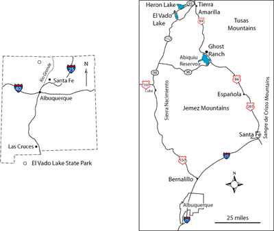
Location
El Vado Lake State Park is located approximately 12 miles southwest of Tierra Amarilla and can be accessed via New Mexico Highway 112 (Figure 1).
Facilities at El Vado State Park
There are facilities at the park, managed by the NM Energy, Minerals, and Natural Resources Department, for many types of recreation. In addition to restrooms, boatramps, and campgrounds, there are beaches, hiking trails, equestrian trails, and a playground.
Introduction
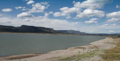
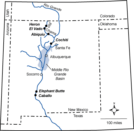
El Vado (“the ford”) Lake lies upstream of a place along the Rio Chama in north central New Mexico where a resistant sandstone ledge in the upper part of the Cretaceous Dakota Sandstone crosses the river. The narrow canyon through this sandstone ledge facilitated passage across the Rio Chama prior to construction of El Vado dam (Owen, 2005). The Middle Rio Grande Conservancy District completed the construction of El Vado dam in 1935 to store irrigation water in order to honor Native American water rights of the six Middle Rio Grande Pueblos. The dam was updated in 1953-1954 and the outlets were modified in 1965-1966 to accommodate increased flows associated with San Juan-Chama Project. The San Juan-Chama Project, managed by the Bureau of Reclamation, takes water from tributaries of the San Juan River, which lies to the west of the Continental Divide, to augment the natural flow of the Rio Grande, which is east of the Continental Divide. The water flows through the Azotea Tunnel under the Continental Divide to Willow Creek, then to Heron Reservoir, just upstream of El Vado Lake, and to the Rio Chama, a tributary of the Rio Grande. The diversion began in 1970, delivering an annual average of 94,200 acre-feet of water to the Rio Grande. Water users include the City of Albuquerque, the City of Santa Fe, the Middle Rio Grande Conservancy District, and the U.S. Department of Energy. The earth fill dam is 154 feet tall and 1,362 feet long. The storage capacity of El Vado Lake is 195,440 acre-feet at a crest elevation of 6,902 feet.
Geology
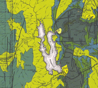
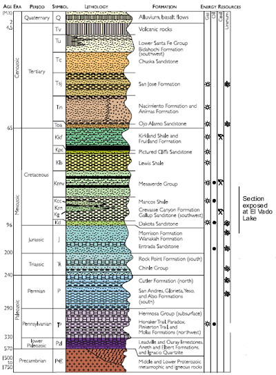
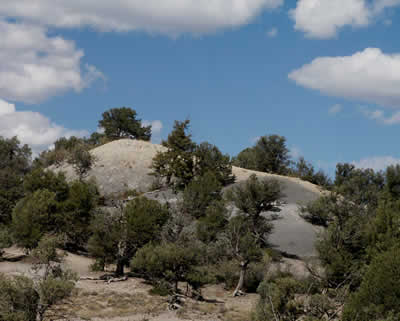
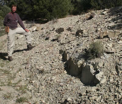
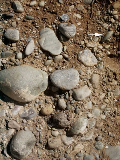
The rocks exposed in El Vado State Park are predominately Late Cretaceous coastal plain, shoreline and marine units that were deposited along the western margin of the Western Interior Seaway. Good outcrops of the upper Dakota Sandstone and the Graneros Shale and Greenhorn Limestone members of the Mancos Shale are exposed on the west side of the dam (Lucas et al., 2005; Figures 3 and 4). The Dakota Sandstone is composed of interbedded tan- to yellow brown-weathering sandstone and dark gray carbonaceous shale and siltstone. Ripple marks on tops of sandstone beds are common. The sandstones are locally cross-bedded, but, in general, the sandstones were intensely burrowed by marine organisms living in the shallow water along the shores of the Western Interior Seaway. Burrows are structures in sedimentary rocks formed by organisms digging or moving through sediment when the sand or mud was soft; organisms burrow through sediments seeking shelter, protection, or food. The Dakota Sandstone records the alternating rise (shale) and fall (sandstones) of sea level as the shoreline moved back and forth across the area~ 98 to 100 million years ago. Gradual, long-term rise in sea level deposited rocks of the Mancos Group, which, from oldest to youngest, include the Graneros Shale, Greenhorn Limestone, Carlile Shale, and Niobrara Formation. These units are made mostly of limy muds deposited on a shallow ocean floor about 98 to 83 million years ago. Gradually sea level dropped again and the shoreline retreated to the northeast, leading to the deposition of the Mesaverde Group. The Mesaverde Group caps the mesas to the west of El Vado Lake. The Mesaverde Group consists of alternating sandstone, siltstone, and coal deposited by rivers flowing into the shallow sea. El Vado Lake lies at the eastern margin of the San Juan Basin, a large structural basin in northwestern New Mexico that developed during compressional Laramide deformation starting about 75 to 80 million years ago (Cather, 2004). Shortly after Laramide deformation began the sea retreated toward the northeast one final time. The geologic record between Late Cretaceous and Quaternary time is missing from this area. The youngest rocks in the area are Quaternary colluvium and landslide deposits and ancient and modern Rio Chama river gravels.
The rock units in the park generally dip 5 to 10° to the west, into the San Juan Basin (Beck and Hallett, 1997). A few small north- to northwest-trending folds and north-striking normal faults disrupt the general west dip of the strata (Beck and Hallett, 1997). Two small domes, North El Vado Dome and South El Vado Dome, lie to the east of the lake. A well was drilled into the northern dome in 1933 to a depth of 347 feet (Fassett et al., 1977b). The southern dome was drilled to depths of 1800 - 2000 feet; the wells bottomed in Precambrian basement. (Fassett et al., 1977a). The wells did not encounter oil or gas.
References
- Beck, W.C., and Hallett, R.B., 1997, Structure, stratigraphy, and petroleum potential of the El Vado area, Rio Arriba County, New Mexico: New Mexico Geological Society Guidebook, 48, p. 65-73.
- Bingler, E.C., 1968, Geology and mineral resources of Rio Arriba County, New Mexico Bureau of Mines and Mineral Resources Bulletin 91, 158 pp.
- Brister, B. S. and Price, L.G., 2002, New Mexico's Energy, Present and Future— Policy, Production, Economics, and the Environment: New Mexico Bureau of Geology and Mineral Resources Decision-Makers Field Guide, San Juan Basin, p. 152.
- Cather, S.M., 2004, The Laramide orogeny in central and northern New Mexico and southern Colorado, in Mack, G.H., and Giles, K.A., eds., The Geology of New Mexico, A Geologic History: New Mexico Geological Society Special Publication 11, p. 203-248.
- Davis, J. H., 1960, Geology of El Vado Area, Rio Arriba County, New Mexico. [M.S. thesis], University of Texas at Austin, 100 pp.
- Fassett, J.E., Jentgen, R.W., Black, B.A., Molenaar, C.M., and Woodward, L.E., 1977a, Second day road log from Red Mountain Oil Field to El Vado Lake via Pueblo Pintado, Star Lake, Torreon, Cuba and Llaves: New Mexico Geological Society Guidebook 28, p. 19-38.
- Fassett, J.E., Black, B.A., Jentgen, R.W, and Osterhoudt, 1977b, Third day road log from El Vado Lake to Farmington via Dulce, Lumberton, Chromo, Ignacio, Colorado, Navaho Dam and Aztec: New Mexico Geological Society Guidebook 28, p. 39-55.
- Landis, E.R., and Dane, C.H., 1967, Geologic map of the Tierra Amarilla quadrangle, Rio Arriba County, New Mexico: New Mexico Bureau of Mining and Mineral Resources Geologic Map 19, 15 pp., Scale 1:62,500.
- Lucas, S.G., Owen, D.E., Zeigler, K.E., Hunt, A.P., and Heckert, A.B., 2005, Tierra Amarilla to El Vado Dam third-day supplemental road log: New Mexico Geological Society Guidebook 58, p. 69-70.
- Owen, D.E., 2005, Dams and lakes of the Chama Basin area: New Mexico Geological Society Guidebook 56, p. 15-16.
- Owen, D.E., Forgas, A.M., Miller, S.A., Stelly, R.J., and, Owen, D.E., Jr., 2005, Surface and subsurface stratigraphy of the Burro Canyon formation, Dakota Sandstone, and intertongued Mancos Shale of the Chama Basin: New Mexico Geological Society Guidebook 56, p. 218-226.