


Featured Products
We are a research and service division of:
The New Mexico Bureau of Geology and Mineral Resources has published geoscience research and information since its inception in 1927. The bookstore at our main office on the campus of New Mexico Tech in Socorro sells our publications as well as publications from NMGS, USGS, and many other publishers. Our bookstore is accross the hall from our Mineral Museum, which is well worth a visit.
Below is a selection of popular featured products that we currently have available:
Valles Caldera Earrings (round)
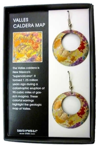
Produced by David Howell & Co., these earrings depict parts of the Geologic Map of the Valles Caldera. The caldera formed during two volcanic super-eruptions that took place 1.6 and 1.2 million years ago. With these earrings, more recent verbal eruptions that you encounter can go in one ear and out the other.
$20.95
Buy
Now
Mount Taylor Puzzle
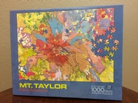
— Fraser Goff, Shari A. Kelley, Cathy J. Goff, David J. McCraw, G. Robert Osbourn, John R. Lawrence, Paul G. Drakos, and Steven J. Skotnicki, 2018
This vibrant 19 x 27" 1000 piece puzzle version of our Geologic Map of Mount Taylor will keep you from finishing that geochemistry paper you should be writing.
$19.95
Buy
Now
Mount Taylor Lava Flow Earrings
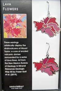
Produced by David Howell & Co., these earrings are a simplified depiction of lava flows shown on our Geologic Map of Mount Taylor, which look a bit like flowers.
$20.95
Buy
Now
NM Bureau of Geology Mineral Museum Gray Adjustable Souvenir Hat
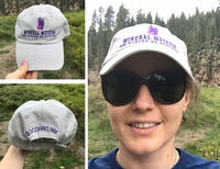
— New Mexico Bureau of Geology and Mineral Resources, 2019
Look great and support the New Mexico Bureau of Geology's Mineral Museum with this fun, stylish hat! Order yours today! *FREE SHIPPING*-LIMITED TIME ONLY! Cart will indicate shipping but you will not be charged!
$29.95
Buy
Now
Adjustable gray cap with purple embroidered front and back lettering and image.
Memoir-50 — Energy and Mineral Resources of New Mexico: Boxed Set
— see individual volumes, 2017
This boxed set of six volumes provides the most comprehensive and extensive review of New Mexico’s energy and mineral resources to-date. Each volume focuses on the geologic nature of the resource, the history of the resource development in New Mexico, and their importance to the world and New Mexico’s economy. Written by New Mexico’s own experts in the fields, this set covers energy resources of petroleum, natural gas, coal, uranium, and geothermal, along with the resources of metals and industrial minerals and rocks.
This memoir is published jointly by the New Mexico Bureau of Geology & Mineral Resources and the New Mexico Geological Society.
Energy and Mineral Resources of New Mexico, NMBGMR, Memoir 50 and NMGS Special Publication 13 (six-volume boxed set)
A: Petroleum Geology — Ronald F. Broadhead
B: Coal Resources — Gretchen K. Hoffman
C: Uranium Resources — Virginia T. McLemore and William L. Chenoweth
D: Metallic Mineral Deposits — Virginia T. McLemore and Virgil W. Lueth
E: Industrial Minerals and Rocks — Virginia T. McLemore and George S. Austin
F: Overview of the Valles Caldera (Baca) Geothermal System — Fraser Goff and Cathy J. Goff
564 pages
ISBN: 978-1-883905-43-9
$125.00
Buy
Now
more details...
Boxed set, Volumes A-F
Also available as a free download.
Bulletin-164 — Climate Change in New Mexico Over the Next 50 Years: Impacts on Water Resources
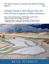
— N.W. Dunbar, D.S. Gutzler, K.S. Pearthree, F.M. Phillips, P.W. Bauer, C.D. Allen, D. DuBois, M.D. Harvey, J.P. King, L.D. McFadden, B.M. Thomson, and A.C. Tillery, 2022
Earth is warming in response to increasing atmospheric carbon dioxide. Global climate models project an average temperature increase across New Mexico of 5° to 7° F over the next 50 years. Other primary impacts are decreased water supply (partly driven by thinner snowpacks and earlier spring melting), lower soil moisture levels, increased frequency and intensity of wildfires, and increased competition and demand for scarce water resources. Snowpack and associated runoff are projected to decline substantially over the next 50 years, generating diminished headwater streamflow. Flow in the state's major rivers is projected to decline by 16% to 28%, and the frequency of extreme precipitation events, coupled with fire-driven disruption of vegetation in watersheds, is projected to at least double river sediment. The impacts of climate change on New Mexico's water resources are overwhelmingly negative.
The bulletin, which is the scientific foundation upon which New Mexico's 50-Year Water Plan is based, represents a compilation, assessment and integration of existing peer-reviewed published research, technical reports and datasets relevant to the broad topic of changes to New Mexico climate over the next 50 years, and resultant impact on water resources. This project, also known as the "Leap Ahead" analysis, also identifies significant data and modeling gaps and uncertainties, and suggests research directions to strengthen our understanding of climate and water resource changes
218 pages
https://doi.org/10.58799/B-164
$10.00
Buy
Now
more details...
Also available as a free download.
Satellite mug
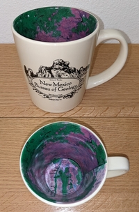
The interior of this mug has a reproduction of our Resource Map-23: Satellite Image of New Mexico. The front of the mug says "New Mexic Bureau of Geology" with a graphic depicting City of Rocks State Park near Deming, New Mexico.
$14.99
Buy
Now
The Geology of Southern NM Parks, Monuments, and Public Lands
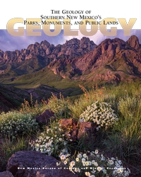
— Peter A. Scholle, Dana S. Ulmer-Scholle, Steven M. Cather, and Shari A. Kelley, [eds.], 2020
Southern New Mexico has a wonderful combination of spectacular scenery and a sparse population. The state’s diverse and interesting geology is reflected in its numerous National and State parks and monuments (including Carlsbad Caverns and White Sands) as well as other publicly accessible lands, which range in size from the multi-million acre Gila wilderness to small roadside turnoffs and picnic areas. This book, crafted by geoscientists but written for the interested public, provides an understanding of the exposed rock units that record more than 1.7 billion years of geologic and biologic changes in this region. With nearly 400 full-color photographs, geologic maps, and illustrations, this book illuminates not just the rocks and fossils of southern New Mexico, but also archaeological/historical sites as well as the water, mineral, and energy resources of the region.
Free sample chapter — White Sands
404 pages
ISBN: 978-1-883905-48-4
$29.95
Buy
Now
more details...
Geologic Map-79 — Geologic Map of the Valles Caldera, Jemez Mountains, New Mexico
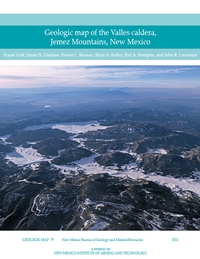
— Fraser Goff, Jamie N. Gardner, Steven L. Reneau, Shari A. Kelley, Kirt A. Kempter, and J. Lawrence, 2011
The Valles caldera, located in the heart of the Jemez Mountains in north-central New Mexico, is the world’s premier example of a resurgent caldera, a giant circular volcano with an uplifted central floor and a near-perfect ring of roughly 15 postcaldera lava dome and flow eruptions.
This new Valles caldera map and cross sections represent the cumulative research efforts of countless geologists over the past 40 years, and several state and federal agencies. GM–79 compiles detailed geologic mapping completed in the past eight years from parts of the nine 7.5–min USGS topographic quadrangles that encompass the caldera. More than 150 map units are described in detail. Also incorporated are new geochronologic data and recent refinements to nomenclature.
Available folded or rolled (additional charge of $5.00 for rolled).
$18.95 plus $6.50 for shipping and handling and 5% gross receipts tax for NM residents.
There is also a bandana and puzzle version of this geologic map available.
ISBN: 9781883905293
https://doi.org/10.58799/GM-79
$18.95
Buy
Now
more details...
One folded sheet + 30 page booklet
Also available as a free download.
Geologic Road Log: Cumbres & Toltec Scenic Railroad
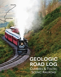
— Shari Kelly, Peter Barkmann, Rob Benson, Jonathan Lovekin, and Lisa Dunn, 2023
This geologic road log describes the diverse geology exposed along the Cumbres & Toltec Scenic Railroad between Antonito, Colorado, and Chama, New Mexico. The booklet was designed for use on the annual "Geotrain" excursion offered by the Cumbres & Toltec Scenic Railroad each summer since 2011. The geologic journey begins in the San Luis Basin in the Rio Grande rift, traverses the southern San Juan volcanic field, and ends in the Chama Basin. The booklet includes a brief introduction to the regional geology of the area, a discussion of the engineering geology associated with building and maintaining the railroad, and descriptions of outcrops exposed in roadcuts along the rail line.
36 pages
ISBN: 978-1-883905-51-4
$9.00
Buy
Now
more details...