


GM-63—Geology of Hermanas quardrangle, Luna County, New Mexico
We are a research and service division of:
By W. R. Seager and R. E. Clemons, 1988, lat 31°47'02" to 31°52'30", long 107°52'30" to 108°00', 1 sheet with text, scale 1:24,000.
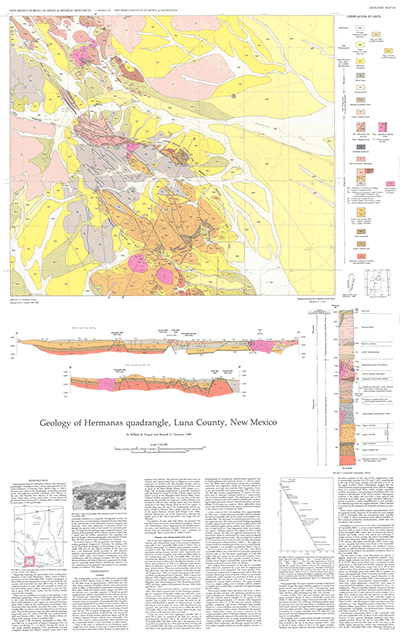
Hermanas quadrangle in southern Luna County adjoins the state of Chihuahua, Mexico, approximately 30 mi south-southwest of Deming. The quadrangle is bisected diagonally northwest-southeast by the Cedar Mountains and Carrizalillo Hills. Hermanas quadrangle was mapped in detail when mapping of the Las Cruces and El Paso 1º x 2º sheets-Geologic Maps 53 (1982), 57 (1987), and 60 (1995) revealed complexly faulted and altered volcanic rocks. The Triassic alteration, swarms of quartz and carbonate veins, and indications of precious metals have attracted the interest of several mining companies. GM-63 includes two cross sections, a stratigraphic column, and chemical and petrographic analyses of the volcanic units. Bulletin 113 also gives a detailed account of this area.
$6.25
Buy
Now
Also available as a free download.
Download
| File Name | Size | Last Modified |
|---|---|---|
| GM-63.pdf | 11.88 MB | 02/05/2021 04:01:40 PM |
| TIFF: | ||
| GM-63_map.tif | 5.87 MB | 07/30/2019 10:00:31 AM |