


El Morro National Monument
We are a research and service division of:
Location
El Morro National Monument is located about 42 miles southwest of Grants along New Mexico Highway 53. El Morro is approximately 15 miles west of El Malpais National Monument.
Regional Geologic Setting
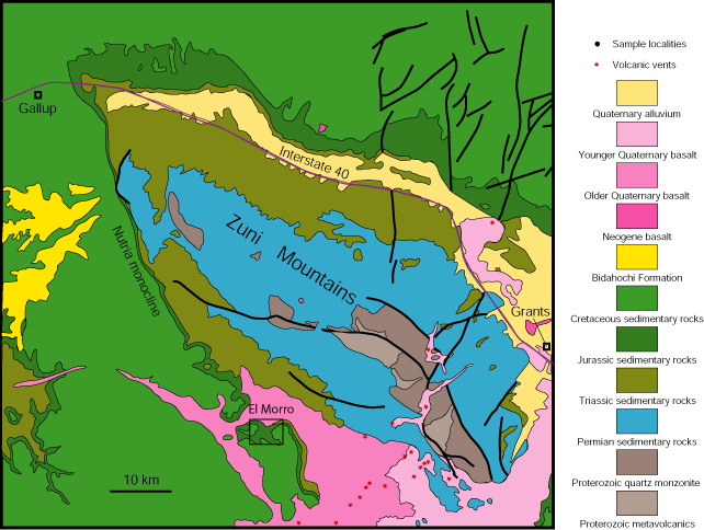
El Morro is on the southwestern flank of the Zuni Mountains, a subdued Proterozoic-cored uplift that formed during Laramide compressional deformation about 75 to 50 million years ago along the southern margin of the Colorado Plateau. The main thrust fault associated with formation of the Zuni Mountains is along the southwestern margin (Figure 3). The Proterozoic basement was shoved toward the southwest along the fault. The rocks within the monument dip gently (3°) toward the southwest away from the Zuni Mountains (Anderson and Maxwell, 1991).
Geology Within the Monument
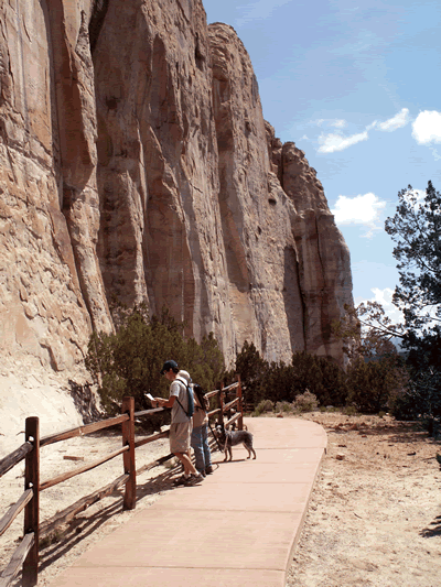
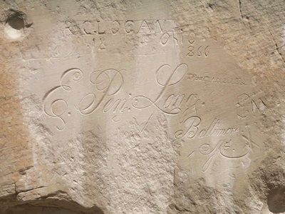
El Morro, which means "bluff" or "headland" in Spanish, is an imposing cliff made of Middle to Late Jurassic (155 to 165 million years old) Zuni Sandstone capped by Late Cretaceous Dakota (~95 to 96 million years old) sandstone and shale. Travelers, including Native Americans, Spaniards, and citizens of the United States, have carved their symbols, names, messages, and dates of their passage into the soft cross-bedded Zuni Sandstone for centuries (Figures 1 and 2)..
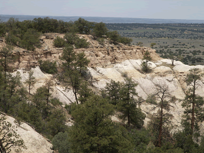
The quartz grains that make up the yellow-gray to tan Zuni Sandstone (Figure 4) are well-rounded and the sandstone is well sorted (Anderson and Maxwell, 1991), which means that the sand grains are all about the same size. Large scale cross-bedding is common in the Zuni Sandstone (Figure 2). These features are characteristic of sand deposited in large eolian (wind-blown) dunes that can form in an arid (dry) environment. These sand dunes were part of a dune field that covered much of northwestern New Mexico, northeastern Arizona, southeastern Utah, and southwestern Colorado about 150 million years ago. The Zuni Sandstone is stratigraphically equivalent to the Entrada Sandstone and the overlying Bluff (Cow Springs) Sandstone to the northeast (Lucas et al., 2003, p.6).
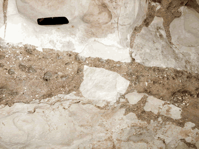
The top of the Zuni Sandstone beneath the Dakota Sandstone is bleached to white several feet below the contact (Figure 5). The contact represents a time gap on the order of 60 million years and the bleached horizon is a paleo-weathering surface. In places, pieces of the underlying Zuni Sandstone have been incorporated into overlying sandy to gravelly stream deposits (Figure 6) of uncertain age (Late Cretaceous (?), Anderson and Maxwell, 1991).
The lower and middle part of the main body of the Late Cretaceous Dakota Sandstone is preserved along the trail within the monument. The lower part is cross-bedded sandstone with lenses of conglomerate containing pebbles of chert and quartzite. The sandstone is overlain by a gray mudstone and shale. The pueblo ruins are built on the gray mudstone to shale unit. This deposit represents streams flowing across the coastal plain along the shores of the Western Interior Seaway in Late Cretaceous time.
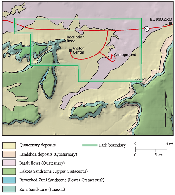
Basalt flows from the Zuni-Bandera volcanic field to the east underlie the low country to the north, northwest, and northeast of the sandstone cliffs (Figures 3 and 4). These basalt flows are ~79,000 years to 1.38 million years old (Anderson and Maxwell, 1991). An apron of younger Quaternary colluvium (rocks eroded from the cliffs), alluvium (water-lain deposits in arroyos), and wind-blown silt surround the sandstone cliffs (Figure 3).
References
- Anderson, O.J., and Maxwell, C.H., 1991, Geology of El Morro quadrangle, Cibola County, New Mexico, New Mexico Bureau of Mines and Mineral Resources Geologic Map 72, scale 1:24,000.
- Geologic Map of New Mexico, 2003, New Mexico Bureau of Geology and Mineral Resources, 1:500,000.
- Kelley, S.A., 2003, Laramide exhumation history of the Zuni Mountains, west-central New Mexico, Geological Society of America Abstracts with Programs, v. 35.
- Lucas, S.G., Semken, S.C., Heckert, A.B., Berglof, W.R., Hoffman, G., Kues, B.S., Crumpler, L.S., and Aubele, J.C., 2003, First-day road log, New Mexico Geological Society Guidebook 54, p. 1-34.