GM-80 — Geologic map of Mount Taylor Volcano Area, New Mexico
We are a research and service division of:
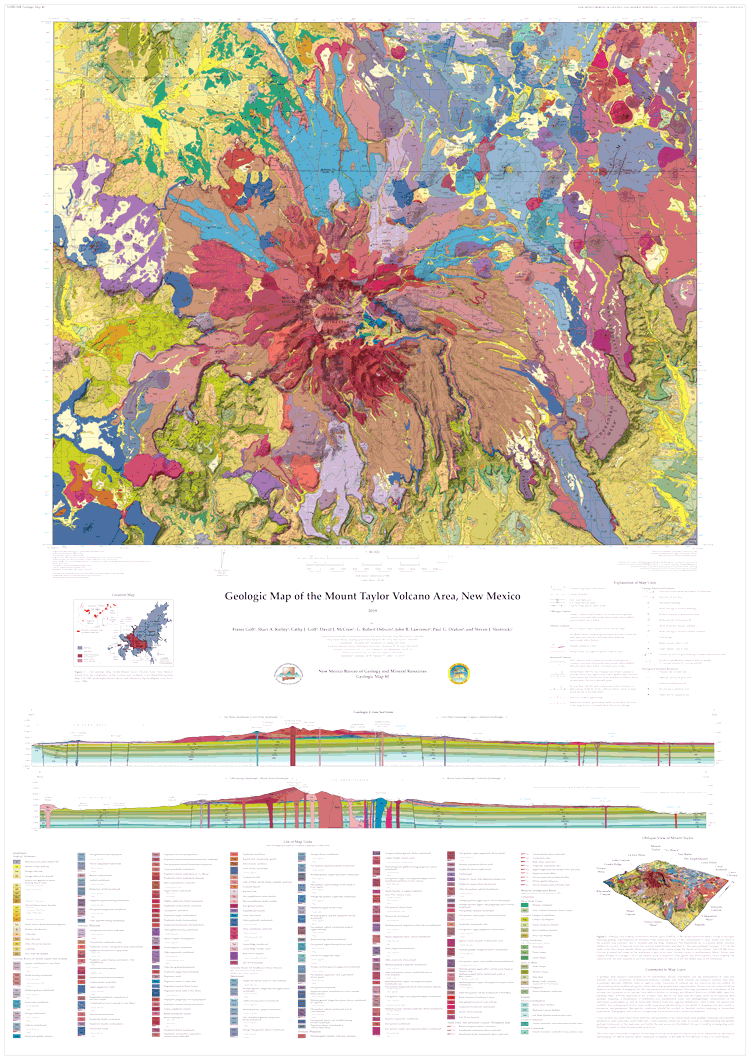
By: Fraser Goff, Shari A. Kelley, Cathy J. Goff, David J. McCraw, G. Robert Osburn, John R. Lawrence, Paul G. Drakos, and Steven J. Skotnicki, 2019, scale 1:36,000
The Geologic Map of the Mount Taylor Volcano Area, New Mexico is a 1:36,000 compilation of six recent NMBGMR 1:24,000 geologic quadrangles that encompass this extinct composite stratovolcano. Mount Taylor is New Mexico's second-largest volcano after the Valles Caldera in the Jemez Mountains. This timely map and accompanying report, resulting from over a decade of thorough work, synthesizes the current geologic understanding of such an important landscape feature of the state.
For such a complex volcanic landform, the report provides an exhaustive description of the volcano area in an easy-to-read format. In addition to providing a detailed description of each of the map's 339 units and dikes, it documents the volcano's history and history of research, its geochemical and petrographic composition, the phases of its construction ranging from the initial to the terminal eruptions, 3.72-1.26 million years ago, and its subsequent erosion, resulting in the summit Amphitheater and its extensive apron of debris. It describes the surrounding volcanic centers, the structure of the area, and the extensive dikes and maars. After touching on the water resources, hydrothermal alteration and mineralization, and geothermal potential, the report concludes with a conceptual model of volcano evolution.
Available folded or rolled on field-durable media. There is also a puzzle version of this geologic map.
GM00080F
ISBN: 978-1-883905-44-6
$24.95
Buy
Now
One 62" x 44" folded sheet + 66 page booklet
GM00080R
ISBN: 978-1-883905-44-6
$24.95
Buy
Now
extra shipping for rolled map
One 62" x 44" rolled sheet + 66 page booklet