


Featured Products
We are a research and service division of:
The New Mexico Bureau of Geology and Mineral Resources has published geoscience research and information since its inception in 1927. The bookstore at our main office on the campus of New Mexico Tech in Socorro sells our publications as well as publications from NMGS, USGS, and many other publishers. Our bookstore is accross the hall from our Mineral Museum, which is well worth a visit.
Below is a selection of popular featured products that we currently have available:
Geologic Map-79 — Geologic Map of the Valles Caldera, Jemez Mountains, New Mexico
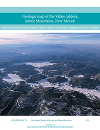
— Fraser Goff, Jamie N. Gardner, Steven L. Reneau, Shari A. Kelley, Kirt A. Kempter, and J. Lawrence, 2011
The Valles caldera, located in the heart of the Jemez Mountains in north-central New Mexico, is the world’s premier example of a resurgent caldera, a giant circular volcano with an uplifted central floor and a near-perfect ring of roughly 15 postcaldera lava dome and flow eruptions.
This new Valles caldera map and cross sections represent the cumulative research efforts of countless geologists over the past 40 years, and several state and federal agencies. GM–79 compiles detailed geologic mapping completed in the past eight years from parts of the nine 7.5–min USGS topographic quadrangles that encompass the caldera. More than 150 map units are described in detail. Also incorporated are new geochronologic data and recent refinements to nomenclature.
Available folded or rolled (additional charge of $5.00 for rolled).
$18.95 plus $6.50 for shipping and handling and 5% gross receipts tax for NM residents.
There is also a bandana and puzzle version of this geologic map available.
ISBN: 9781883905293
https://doi.org/10.58799/GM-79
$18.95
Buy
Now
more details...
One folded sheet + 30 page booklet
Also available as a free download.
Special Publication-15 — A History of the Geology Program at New Mexico State University: 1890 to 2015
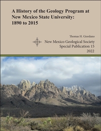
— Thomas H. Giordano, 2022
The history behind the Department of Geological Sciences at New Mexico State University goes back one hundred and thirty years and is complex. This history, as told in the pages of this monograph, documents the important details behind the founding of the NMSU geology program and its growth and evolution to 2015. The program's history is conveniently divided into three administrative phases. Phase I comprises the first 55 years, during which the program's activities were managed by one or two regular academic departments of the University. In the Earth Sciences phase, the geology program was administered as a division, along with one or two other divisions in the same department. In its third phase, the geology program became a regular academic department within the College of Arts and Sciences, its current status as the Department of Geological Sciences. Two obvious legacies of NMSU's geology program are the Department of Geological Sciences and the geophysics program in the Department of Physics. However, the program's legacy is also reflected in the students who have taken its courses and the program's research output through the efforts of its faculty, graduate students, and undergraduate students. Since the mid-1960s, the geology program has produced a vast amount of research that has led to a sophisticated understanding of the geology of southern New Mexico and adjacent areas. Finally, through a better understanding of the geology program's academic evolution, the program's alumni and current students, faculty, and staff will have a more profound appreciation of their academic experience at New Mexico State University
Note:
This publication can be downloaded for free or can be purchased as an on-demand printed book.
NMGS, 45 pages
ISBN: 1-58546-114-8
https://doi.org/10.56577/SP-15
Softcover:
$20.00
Buy
Now
more details...
Guidebook-71 — Geology of the Mount Taylor area
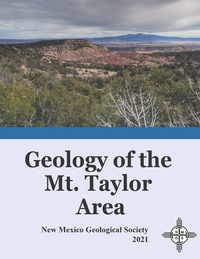
— Bonnie A. Frey, Shari A. Kelley, Kate E. Zeigler, Virginia T. McLemore, Fraser Goff, and Dana S. Ulmer-Scholle, 2021
The Mt. Taylor area is a crossroad where geologic history, human history, and societal impacts intersect. Situated on the eastern edge of the Colorado Plateau and flanking the transition zone to the Rio Grande rift, Mt. Taylor is a late Pliocene stratovolcano located on the Jemez Lineament, an enigmatic NE-trending alignment of late Cenozoic volcanic centers. Mt. Taylor lies along the southeast margin of the San Juan Basin bounded by the Zuni (south) and Nacimiento (east) uplifts. Mt. Taylor also has some of the richest uranium deposits in the United States.
The human history of the Mt. Taylor region is no less compelling. Indigenous communities lived here for thousands of years despite Spanish conquest and the establishment of land grants. In the 1800s, the area was settled as part of a U.S. territory, bringing with it commerce such as the railroad and timber industries, and later the uranium boom and its lasting legacy. Additional corridors of commerce opened with Route 66, succeeded by Interstate 40. The designation of Mt. Taylor as a Traditional Cultural Property recognizes the mountain's importance to Native, Spanish and U.S. cultures.
The papers in this volume cover a spectrum of topics, ranging from geologic studies and mining history to the effects of mining on the population and the environment today.
There are two versions of this guidebook available, the complete guidebook (310 pages), and a version with just the road logs that is spiral bound (94 pages).
NMGS, 310 pages
ISBN: 1-58546-112-1
https://doi.org/10.56577/FFC-71
Softcover:
$65.00
Buy
Now
more details...
Individual papers from this guidebook are available as free downloads from the NMGS site.
Geology of Northern New Mexico's Parks, Monuments, and Public Lands
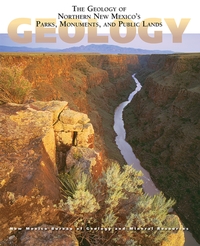
— L. Greer Price, [ed.], 2010
Few places in the U.S. boast as rich a diversity of landscape and public lands as northern New Mexico. Here in one volume is an authoritative overview of the geology of these parks, monuments, and public lands, with information on the regional setting, the rock record, and the most prominent geologic features. The book includes chapters on nine national parks and monuments, seventeen state parks, and many of the most popular Bureau of Land Management and U.S. Forest Service units in this part of the state. Also included are chapters on two of our newer units, the Valles Caldera National Preserve and Kashe-Katuwe Tent Rocks National Monument. With nearly 300 full-color geologic maps, graphics, and photographs, the book is a perfect introduction to the some of New Mexico's most significant geologic landscapes.
Free sample chapter—Ghost Ranch (4 MB PDF)
372 pages
ISBN: 9781883905255
$29.95
Buy
Now
more details...
Third revised reprinting
Geologic Map-80 — Geologic Map of Mount Taylor Volcano Area, New Mexico
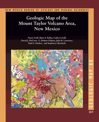
— Fraser Goff, Shari A. Kelley, Cathy J. Goff, David J. McCraw, G. Robert Osburn, John R. Lawrence, Paul G. Drakos, and Steven J. Skotnicki, 2019
The Geologic Map of the Mount Taylor Volcano Area, New Mexico is a 1:36,000 compilation of six recent NMBGMR 1:24,000 geologic quadrangles that encompass this extinct composite stratovolcano. Mount Taylor is New Mexico’s second-largest volcano after the Valles Caldera in the Jemez Mountains. This timely map and accompanying report, resulting from over a decade of thorough work, synthesizes the current geologic understanding of such an important landscape feature of the state.
For such a complex volcanic landform, the report provides an exhaustive description of the volcano area in an easy-to-read format. In addition to providing a detailed description of each of the map’s 339 units and dikes, it documents the volcano’s history and history of research, its geochemical and petrographic composition, the phases of its construction ranging from the initial to the terminal eruptions, 3.72–1.26 million years ago, and its subsequent erosion, resulting in the summit Amphitheater and its extensive apron of debris. It describes the surrounding volcanic centers, the structure of the area, and the extensive dikes and maars. After touching on the water resources, hydrothermal alteration and mineralization, and geothermal potential, the report concludes with a conceptual model of volcano evolution.
Available folded or rolled on field-durable media. There is also a puzzle version of this geologic map.
66 pages
ISBN: 978-1-883905-44-6
https://doi.org/10.58799/GM-80
$24.95
Buy
Now
more details...
One 62" x 44" folded sheet + 66 page booklet
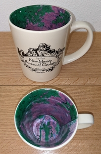
Valles Caldera mug

The interior of this mug has a reproduction of our Geologic Map of the Valles Caldera. The caldera once was filled by a lake, but you can fill it with coffee, tea, or whatever else satisfies your inner volcanologist.
$14.99
Buy
Now
calendar- — 2024 Calendar
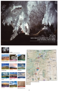
— NMBGMR, 2024
This calendar highlights photographs from the fine amateur photographers on staff at the New Mexico Bureau of Geology. We hold an annual internal contest, and the winning images are used for our calendar. These images were taken throughout the state, and most are geologically themed.
$10.00
Buy
Now
Note: availability of this publication
is limited!
Mount Taylor Puzzle
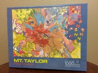
— Fraser Goff, Shari A. Kelley, Cathy J. Goff, David J. McCraw, G. Robert Osbourn, John R. Lawrence, Paul G. Drakos, and Steven J. Skotnicki, 2018
This vibrant 19 x 27" 1000 piece puzzle version of our Geologic Map of Mount Taylor will keep you from finishing that geochemistry paper you should be writing.
$19.95
Buy
Now
Satellite mug
The interior of this mug has a reproduction of our Resource Map-23: Satellite Image of New Mexico. The front of the mug says "New Mexic Bureau of Geology" with a graphic depicting City of Rocks State Park near Deming, New Mexico.
$14.99
Buy
Now
The Geology of Southern NM Parks, Monuments, and Public Lands
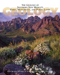
— Peter A. Scholle, Dana S. Ulmer-Scholle, Steven M. Cather, and Shari A. Kelley, [eds.], 2020
Southern New Mexico has a wonderful combination of spectacular scenery and a sparse population. The state’s diverse and interesting geology is reflected in its numerous National and State parks and monuments (including Carlsbad Caverns and White Sands) as well as other publicly accessible lands, which range in size from the multi-million acre Gila wilderness to small roadside turnoffs and picnic areas. This book, crafted by geoscientists but written for the interested public, provides an understanding of the exposed rock units that record more than 1.7 billion years of geologic and biologic changes in this region. With nearly 400 full-color photographs, geologic maps, and illustrations, this book illuminates not just the rocks and fossils of southern New Mexico, but also archaeological/historical sites as well as the water, mineral, and energy resources of the region.
Free sample chapter — White Sands
404 pages
ISBN: 978-1-883905-48-4
$29.95
Buy
Now
more details...