


GM-11 — Reconnaissance Geologic Map of Little Black Peak Fifteen-minute Quadrangle, East Half
We are a research and service division of:
By Clay T. Smith and A.J. Budding, 1959, scale 1:62,500.
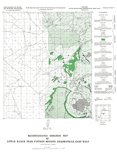
Only the east half of this quadrangle is mapped and covers a portion of the Oscura Mountains. The unmapped area lies in the Jornada del Muerto.
$3.25
Buy
Now
Also available as a free download.
Download
| File Name | Size | Last Modified |
|---|---|---|
| GM-11_map.pdf | 4.52 MB | 02/05/2021 02:49:51 PM |
| TIFF: | ||
| GM-11_map-pal.tif | 3.36 MB | 09/19/2018 02:31:21 PM |
| GM-11_map.tif | 23.34 MB | 09/19/2018 02:30:32 PM |