


GM-15 — Reconnaissance Geologic Map of Virden Thirty-minute Quadrangle
We are a research and service division of:
By Wolfgang E. Elston, 1960, scale 1:126,720.
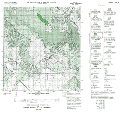
This map covers the Gila River and surrounding highlands from the towns of Gila and Cliff to the Arizona state line. Other towns in the map area include Virden and Redrock. Late Cretaceous to Tertiary igneous rocks and the Tertiary Gila Conglomerate cover most of the mapped area, but there are also exposures of Cretaceous sediments and Precambrian basement.
Related 30-minute geologic maps of this region include:
- GM-1 — Hillboro Peak
- GM-2 — Luera Spring
- GM-3 — Piñonville
- GM-5 — Datil
- GM-6 — Cañon Largo
- GM-10 — Mogollon
- GM-12 — Reserve
- GM-13 — Alum Mountain
- GM-14 — Las Cruces
- GM-23 — Pelona
$3.25
Buy
Now
Also available as a free download.
Download
| File Name | Size | Last Modified |
|---|---|---|
| GM-15_map.pdf | 8.17 MB | 02/05/2021 02:50:18 PM |
| TIFF: | ||
| GM-15_map-pal.tif | 6.51 MB | 09/19/2018 10:13:12 AM |
| GM-15_map.tif | 45.06 MB | 09/19/2018 10:11:54 AM |