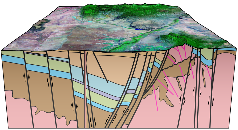
3d Cross-Section of the Albuquerque Basin

3D block diagram showing the subsurface beneath Albuquerque, NM in the vicinity of Lomas Boulevard.
by: Sean Connell and Adam Read
©
New Mexico Bureau of Geology and Mineral Resources
Longitude: -106.609991
Latitude: 35.110703
(WGS 84 or NAD 83)
About this image
The Albuquerque basin is an east-tilted half graben within the Rio Grande rift. Pennsylvanian sedimentary rocks exposed on Sandia Crest have been faulted and deeply buried in the basin with a throw (or offset) of about 5 miles.
[See more information related to this image...]
Image posted: 12-17-2021


