


Featured Products
We are a research and service division of:
The New Mexico Bureau of Geology and Mineral Resources has published geoscience research and information since its inception in 1927. The bookstore at our main office on the campus of New Mexico Tech in Socorro sells our publications as well as publications from NMGS, USGS, and many other publishers. Our bookstore is accross the hall from our Mineral Museum, which is well worth a visit.
Below is a selection of popular featured products that we currently have available:
Memoir-50 — Energy and Mineral Resources of New Mexico: Boxed Set
— see individual volumes, 2017
This boxed set of six volumes provides the most comprehensive and extensive review of New Mexico’s energy and mineral resources to-date. Each volume focuses on the geologic nature of the resource, the history of the resource development in New Mexico, and their importance to the world and New Mexico’s economy. Written by New Mexico’s own experts in the fields, this set covers energy resources of petroleum, natural gas, coal, uranium, and geothermal, along with the resources of metals and industrial minerals and rocks.
This memoir is published jointly by the New Mexico Bureau of Geology & Mineral Resources and the New Mexico Geological Society.
Energy and Mineral Resources of New Mexico, NMBGMR, Memoir 50 and NMGS Special Publication 13 (six-volume boxed set)
A: Petroleum Geology — Ronald F. Broadhead
B: Coal Resources — Gretchen K. Hoffman
C: Uranium Resources — Virginia T. McLemore and William L. Chenoweth
D: Metallic Mineral Deposits — Virginia T. McLemore and Virgil W. Lueth
E: Industrial Minerals and Rocks — Virginia T. McLemore and George S. Austin
F: Overview of the Valles Caldera (Baca) Geothermal System — Fraser Goff and Cathy J. Goff
564 pages
ISBN: 978-1-883905-43-9
$125.00
Buy
Now
more details...
Boxed set, Volumes A-F
Also available as a free download.
Geologic Map-80 — Geologic Map of Mount Taylor Volcano Area, New Mexico
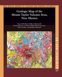
— Fraser Goff, Shari A. Kelley, Cathy J. Goff, David J. McCraw, G. Robert Osburn, John R. Lawrence, Paul G. Drakos, and Steven J. Skotnicki, 2019
The Geologic Map of the Mount Taylor Volcano Area, New Mexico is a 1:36,000 compilation of six recent NMBGMR 1:24,000 geologic quadrangles that encompass this extinct composite stratovolcano. Mount Taylor is New Mexico’s second-largest volcano after the Valles Caldera in the Jemez Mountains. This timely map and accompanying report, resulting from over a decade of thorough work, synthesizes the current geologic understanding of such an important landscape feature of the state.
For such a complex volcanic landform, the report provides an exhaustive description of the volcano area in an easy-to-read format. In addition to providing a detailed description of each of the map’s 339 units and dikes, it documents the volcano’s history and history of research, its geochemical and petrographic composition, the phases of its construction ranging from the initial to the terminal eruptions, 3.72–1.26 million years ago, and its subsequent erosion, resulting in the summit Amphitheater and its extensive apron of debris. It describes the surrounding volcanic centers, the structure of the area, and the extensive dikes and maars. After touching on the water resources, hydrothermal alteration and mineralization, and geothermal potential, the report concludes with a conceptual model of volcano evolution.
Available folded or rolled on field-durable media. There is also a puzzle version of this geologic map.
66 pages
ISBN: 978-1-883905-44-6
https://doi.org/10.58799/GM-80
$24.95
Buy
Now
more details...
One 62" x 44" folded sheet + 66 page booklet
Guidebook-71 — Geology of the Mount Taylor area
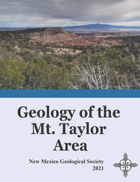
— Bonnie A. Frey, Shari A. Kelley, Kate E. Zeigler, Virginia T. McLemore, Fraser Goff, and Dana S. Ulmer-Scholle, 2021
The Mt. Taylor area is a crossroad where geologic history, human history, and societal impacts intersect. Situated on the eastern edge of the Colorado Plateau and flanking the transition zone to the Rio Grande rift, Mt. Taylor is a late Pliocene stratovolcano located on the Jemez Lineament, an enigmatic NE-trending alignment of late Cenozoic volcanic centers. Mt. Taylor lies along the southeast margin of the San Juan Basin bounded by the Zuni (south) and Nacimiento (east) uplifts. Mt. Taylor also has some of the richest uranium deposits in the United States.
The human history of the Mt. Taylor region is no less compelling. Indigenous communities lived here for thousands of years despite Spanish conquest and the establishment of land grants. In the 1800s, the area was settled as part of a U.S. territory, bringing with it commerce such as the railroad and timber industries, and later the uranium boom and its lasting legacy. Additional corridors of commerce opened with Route 66, succeeded by Interstate 40. The designation of Mt. Taylor as a Traditional Cultural Property recognizes the mountain's importance to Native, Spanish and U.S. cultures.
The papers in this volume cover a spectrum of topics, ranging from geologic studies and mining history to the effects of mining on the population and the environment today.
There are two versions of this guidebook available, the complete guidebook (310 pages), and a version with just the road logs that is spiral bound (94 pages).
NMGS, 310 pages
ISBN: 1-58546-112-1
https://doi.org/10.56577/FFC-71
Softcover:
$65.00
Buy
Now
more details...
Individual papers from this guidebook are available as free downloads from the NMGS site.
Mineral Museum postcards: The Fluorites of New Mexico (set of 8)
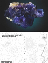
— Jeff Scovil
This set of 8 postcards highlight flourites found throughout New Mexico. Each variety was photographed by Jeff Scovil. Send these back to your mineral collecting friends when you are on your next rock hounding adventure.
Enclosed in a cardstock case.
$10.00
Buy
Now
The Rio Chama: A River Guide to the Geology and Landscapes
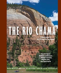
— Paul W. Bauer, Matthew Zimmerer, J. Michael Timmons, Brigitte Felix, and Steve Harris, 2021
The 135-mile Rio Chama of northern New Mexico is a major tributary of the Rio Grande. From its alpine headwaters at the Continental Divide of the glaciated San Juan Mountains in southern Colorado, this hidden gem flows across the Colorado Plateau in a spectacular canyon cut into Mesozoic sedimentary rocks, in places up to 1,500 feet deep. Towering, vibrant, sandstone cliffs, heavily wooded side canyons, superb camping, and a diversity of historical sites offer an outstanding wild river backdrop for the boater, angler, hiker, or camper.
This book contains detailed river maps of the seven sections of the Rio Chama, plus its three resplendent reservoirs, from the Colorado headwaters to its confluence with the Rio Grande near Española. The Chama Canyon section, below El Vado Dam and through the Chama Canyon Wilderness, is one of the finest, multi-day, whitewater trips in the Southwest.
134 pages
ISBN: 978-1-883905-32-3
$18.95
Buy
Now
more details...
Valles Caldera mug
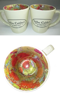
The interior of this mug has a reproduction of our Geologic Map of the Valles Caldera. The caldera once was filled by a lake, but you can fill it with coffee, tea, or whatever else satisfies your inner volcanologist.
$14.99
Buy
Now
Satellite mug
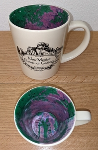
The interior of this mug has a reproduction of our Resource Map-23: Satellite Image of New Mexico. The front of the mug says "New Mexic Bureau of Geology" with a graphic depicting City of Rocks State Park near Deming, New Mexico.
$14.99
Buy
Now
Bulletin-164 — Climate Change in New Mexico Over the Next 50 Years: Impacts on Water Resources
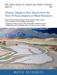
— N.W. Dunbar, D.S. Gutzler, K.S. Pearthree, F.M. Phillips, P.W. Bauer, C.D. Allen, D. DuBois, M.D. Harvey, J.P. King, L.D. McFadden, B.M. Thomson, and A.C. Tillery, 2022
Earth is warming in response to increasing atmospheric carbon dioxide. Global climate models project an average temperature increase across New Mexico of 5° to 7° F over the next 50 years. Other primary impacts are decreased water supply (partly driven by thinner snowpacks and earlier spring melting), lower soil moisture levels, increased frequency and intensity of wildfires, and increased competition and demand for scarce water resources. Snowpack and associated runoff are projected to decline substantially over the next 50 years, generating diminished headwater streamflow. Flow in the state's major rivers is projected to decline by 16% to 28%, and the frequency of extreme precipitation events, coupled with fire-driven disruption of vegetation in watersheds, is projected to at least double river sediment. The impacts of climate change on New Mexico's water resources are overwhelmingly negative.
The bulletin, which is the scientific foundation upon which New Mexico's 50-Year Water Plan is based, represents a compilation, assessment and integration of existing peer-reviewed published research, technical reports and datasets relevant to the broad topic of changes to New Mexico climate over the next 50 years, and resultant impact on water resources. This project, also known as the "Leap Ahead" analysis, also identifies significant data and modeling gaps and uncertainties, and suggests research directions to strengthen our understanding of climate and water resource changes
218 pages
https://doi.org/10.58799/B-164
$10.00
Buy
Now
more details...
Also available as a free download.
Bulletin-165 — Quaternary and Archaeological Geology of the Mescalero Plain, Southeastern New Mexico
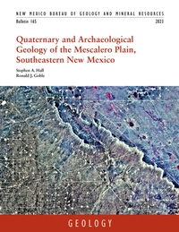
— Stephen A. Hall and Ronald J. Goble, 2023
This bulletin synthesizes 177 optically stimulated luminescence (OSL) and 54 radiocarbon dates, as well as detailed sediment size and chemical signature data, to document the history of eolian sand deposition during the late Pleistocene and Holocene in southeastern New Mexico. The authors use this history, which is based on 20 years of field observations, to assess the preservation potential of archeological sites in this area. The bulletin is richly illustrated with photographs and figures that clearly tell the story of unearthing discoveries that were previously hidden beneath the shifting sands of southeastern New Mexico.
216 pages
https://doi.org/10.58799/B-165
$10.00
Buy
Now
more details...
Also available as a free download.
NM Bureau of Geology Mineral Museum Gray Adjustable Souvenir Hat
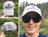
— New Mexico Bureau of Geology and Mineral Resources, 2019
Look great and support the New Mexico Bureau of Geology's Mineral Museum with this fun, stylish hat! Order yours today! *FREE SHIPPING*-LIMITED TIME ONLY! Cart will indicate shipping but you will not be charged!
$29.95
Buy
Now
Adjustable gray cap with purple embroidered front and back lettering and image.