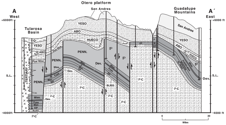
Cross Section of the Otero Platform

Cross Section A-A' indicating complexity of subsurface, Ancestral Rocky Mountains structure beneath the Otero Platform.
by: Ron Broadhead
Longitude: -105.882201
Latitude: 32.412597
(WGS 84 or NAD 83)
About this image
Figure 4 from:
Broadhead, Ronald F., 2002, Petroleum geology of the McGregor Range, Otero County, New Mexico,in: Geology of White Sands, Lueth, Virgil W.; Giles, Katherine A.; Lucas, Spencer G.; Kues, Barry S.; Myers, Robert; Ulmer, Scholle, Dana S., ed(s), New Mexico Geological Society, Guidebook, 53rd Field Conference, pp. 331-338. ISBN: 1-58546-088-5-4
Image posted: 12-17-2021


