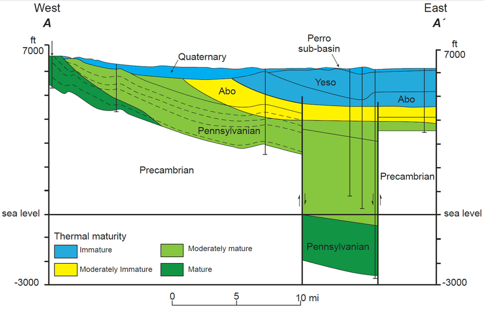
Thermal Maturity in the Subsurface of the Estancia Basin

Figure 20 from Bulletin 157
by: Ron Broadhead
©
1997
New Mexico Bureau of Geology and Mineral Resources
Longitude: -106.055851
Latitude: 34.758393
(WGS 84 or NAD 83)
About this image
East-west structural cross section through Estancia Basin, showing thermal maturity Paleozoic section.
Figure 20 from:
Broadhead, Ronald F., 1997, Subsurface geology and oil and gas potential of Estancia Basin, New Mexico, New Mexico Bureau Mines Mineral Resources, Bulletin, v. 157, pp. 1-54.
[See more information related to this image...]
Image posted: 12-17-2021


