


GM-17 — Reconnaissance Geologic Map of Southern Animas Mountains
We are a research and service division of:
By Robert A. Zeller, Jr., 1962, scale 1:62,500.
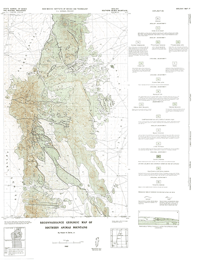
This map covers about half of the bootheel region of New Mexico to the border with Mexico. The mapped area includes portions of the Animas Peak, Wallnut Wells, Cienega Springs, and Antelope Wells 15-minute quadrangles.
$3.00
Buy
Now
Also available as a free download.
Download
| File Name | Size | Last Modified |
|---|---|---|
| GM-17_map.pdf | 10.73 MB | 02/05/2021 02:50:35 PM |
| TIFF: | ||
| GM-17_map-pal.tif | 11.30 MB | 09/18/2018 03:36:15 PM |
| GM-17_map.tif | 73.51 MB | 09/18/2018 03:34:13 PM |