


GM-21 — Reconnaissance Geologic Map and Section of Valle Grande Peak Seven and One Half Minute Quadrangle, New Mexico
We are a research and service division of:
By E.C. Bingler, P. Hillard, and K.H. Mallon, 1968, scale 1:24,000.
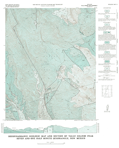
The Valle Grande Peak 7.5-minute quadrangle is just north of the El Rito quadrangle (GM-20, also published in 1968 by the same authors) and the town of El Rito. This quadrangle lies on the western flank of the Ortega Mountians. The rocks exposed in the map area are principally the Precambrian Ortega Quartzite and several Tertiary conglomerates.
Note: This quadrangle was also mapped as OF-GM-180 in 2008.
$4.00
Buy
Now
Also available as a free download.
Download
| File Name | Size | Last Modified |
|---|---|---|
| GM-21_map.pdf | 12.85 MB | 02/05/2021 02:53:36 PM |
| TIFF: | ||
| GM-21_map-pal.tif | 12.01 MB | 09/18/2018 10:57:42 AM |
| GM-21_map.tif | 88.81 MB | 09/18/2018 10:56:17 AM |