


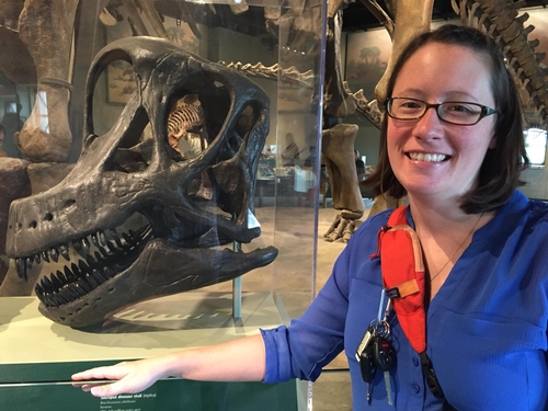
Amy Dunn
We are a research and service division of:
New Mexico Bureau of Geology & Mineral Resources
New Mexico Institute of Mining & Technology
801 Leroy Place
Socorro NM 87801-4796
575-835-5501
(575) 835-6333 fax
I am one of the GIS Technician/Cartographers within the Geologic Map Production Group at the New Mexico Bureau of Geology and Mineral Resources. I will be working with data collected by the field geologists and using ArcGIS, Adobe Illustrator and Global Mapper to update legacy quadrangles and produce geologic maps for the USGS STATEMAP program and other Bureau publications. I have a BS in Geology from Michigan Tech and a graduate certificate in GIS from Northwest Missouri State. I grew up in Michigan and have also lived in South Dakota, and Colorado. My husband's job as a paleontologist for the Bureau of Land Management in Las Cruces brought us to New Mexico in 2017. Outside of work, I enjoy playing with our cats, playing board games, reading, hiking, crafting, camping, and traveling.
Updated Feb 2022.
Education
- University of Arizona
- Masters in Geographic Information Systems Technology, expected graduation May 2025
- Northwest Missouri State University
- Graduate Certificate in GIScience, 2012
- Michigan Technological University
- B.S. in Geology, 2010
- Geology Club Vice President
- Huskies Pep Band, clarinet
- B.S. in Geology, 2010
- Mid Michigan Community College
- Associates in Science, 2007
Experience
- New Mexico Bureau of Geology and Mineral Resources, New Mexico Tech
- GIS Technician/Cartographer Dec 2018–Present
- Bureau of Land Management Las Cruces District Office
- GIS Volunteer, Feb 2018–Present
- Worked with a range specialist to edit and update spatial data for range improvement projects on various grazing allotments.
- Collected GPS data and photos for a road inventory for Organ Mountains - Desert Peaks and Prehistoric Trackways National Monuments.
- GIS Volunteer, Feb 2018–Present
- Traffic Operations, City of Rapid City, South Dakota
- GIS Intern, Jul 2011–Jun 2015
- Collected GPS data on traffic signs for a sign inventory geodatabase.
- GIS Intern, Jul 2011–Jun 2015
Memberships
GIS and Cartographic Projects
- NMBGMR, 2022, Geologic Map Database of New Mexico, adapted from Geologic Map of New Mexico, New Mexico Bureau of Geology and Mineral Resources, 2003, scale 1:500,000: NMBGMR OF-GM 304, File Geodatabase, scale 1:500,000
- Kelley, Shari A. and Rees, Shannon, 2022, Geologic Map of the Taylor Well 7.5-Minute Quadrangle, Doña Ana County, New Mexico: NMBGMR OF-GM 302, scale 1:24,000
- Bauer, Paul W., Kelson, Keith, I., Aby, Scott B., Helper, Mark A., and Mansell, Mark M., 2021, Geologic Map of the Picuris Mountains, Taos and Rio Arriba Counties, New Mexico: NMBGMR OF-GM 294, scale 1:24,000
- Koning, Daniel J., Jochems, Andrew P., Hobbs, Kevin M., Pearthree, Kristin S., and Love, David W., 2020, Geologic Map of the Paraje Well 7.5-Minute Quadrangle, Socorro County, New Mexico: NMBGMR OF-GM 286, scale 1:24,000
- Koning, Daniel J., Pearthree, Kristin S., Jochems, Andrew P., and Love, David W., 2020, Geologic Map of the San Marcial 7.5-Minute Quadrangle, Socorro County, New Mexico: NMBGMR OF-GM 287, scale 1:24,000
- Jochems, Andrew P., Kelley, Shari A., and Seager, William R., 2020, Geologic Map of the Tortugas Mountain 7.5-Minute Quadrangle, Doña Ana County, New Mexico: NMBGMR OF-GM 280, scale 1:24,000
- Rawling, Geoffrey C., 2020, Geologic Map of the Cañoncito School 7.5-Minute Quadrangle, Rio Arriba County, New Mexico: NMBGMR OF-GM 280, scale 1:24,000
- Cikoski, Colin T., 2019, Geologic Map of the Kitchen Cove 7.5-Minute Quadrangle, Eddy County, New Mexico: NMBGMR OF-GM 276, scale 1:24,000
- Jochems, Andrew P. and Koning, Daniel J., 2019, Geologic Map of the Black Hill 7.5-Minute Quadrangle, Socorro County, New Mexico: NMBGMR OF-GM-274, scale 1:24,000
- Rawling, Geoffrey C., 2004, Geologic Map of the Angus 7.5-Minute Quadrangle, Lincoln County, New Mexico: NMBGMR OF-GM 95, scale 1:24,000.