


Geologic Mapping Program
Open-File Geologic Map Series (OF-GM)
Open-file Geologic Maps Listed by Map Number
Some publications, including
those that are out-of-print, are only available for purchase on CD or DVD-ROM ![]() .
.
| Stock# | Title | Price / Details |
|---|---|---|
| OF-GM-150 |
 Geologic map of the Canjilon SE quadrangle, Rio Arriba County, New Mexico, Kempter, K. A.; Zeigler, K.; Koning, D. J.; Lucas, S., 2007, Scale 1:24,000, [CD/DVD-ROM on demand].
|
$10.00Buy Now
|
| OF-GM-151 |
 Geologic map of the Bitter Lake quadrangle, Chaves County, New Mexico, McCraw, David J.; Rawling, Geoffrey; Land, Lewis A., 2007, Scale 1:24,000, [CD/DVD-ROM on demand].
|
$10.00Buy Now
|
| OF-GM-152 |
 Geologic map of the Fort Bayard quadrangle, Grant County, New Mexico, Skotnicki, Steve J.; Ferguson, Charles A., 2007, Scale 1:24,000, [CD/DVD-ROM on demand].
|
$10.00Buy Now
|
| OF-GM-153 |
 Geologic map of the Alamogordo North 7.5-minute quadrangle, Otero County, New Mexico, Koning, D. J.; Hallett, B.; Shaw, C., 2007, Scale 1:24,000, [CD/DVD-ROM on demand].
|
$10.00Buy Now
|
| OF-GM-154 |
 Geologic map of the Harvey Ranch quadrangle, Otero County, New Mexico, Hallett, Benjamin, 2007, Scale 1:24,000, [CD/DVD-ROM on demand].
|
$10.00Buy Now
|
| OF-GM-155 |
 Geologic map of the Mayhill quadrangle, Otero County, New Mexico, Hallett, Benjamin, 2007, Scale 1:24,000, [CD/DVD-ROM on demand].
|
$10.00Buy Now
|
| OF-GM-156 |
 Geologic map of the Sacramento quadrangle, Otero County, New Mexico, Rawling, Geoffrey, 2007, Scale 1:24,000, [CD/DVD-ROM on demand].
|
$10.00Buy Now
|
| OF-GM-157 |
 Geologic map of the Woodson Canyon 7.5-minute quadrangle map, Otero County, New Mexico, Rawling, Geoffrey, 2007, Scale 1:24,000, [CD/DVD-ROM on demand].
|
$10.00Buy Now
|
| OF-GM-158 |
 Geologic map of the Bear Spring 7.5-minute quadrangle map, Otero County, New Mexico, Rawling, Geoffrey, 2007, Scale 1:24,000, [CD/DVD-ROM on demand].
|
$10.00Buy Now
|
| OF-GM-159 |
 Geologic map of the Avis 7.5-minute quadrangle map, Otero County, New Mexico, Rawling, Geoffrey, 2007, Scale 1:24,000, [CD/DVD-ROM on demand].
|
$10.00Buy Now
|
| OF-GM-160 |
 Geologic map of the Dayton 7.5-minute quadrangle, Eddy County, New Mexico, McCraw, David J.; Williams, Shannon, 2011, Scale 1:24,000, [CD/DVD-ROM on demand].
|
$10.00Buy Now
|
| OF-GM-161 |
 Geologic map of the Surveyors Canyon 7.5-minute quadrangle map, Otero County, New Mexico, Rawling, Geoffrey, 2007, Scale 1:24,000, [CD/DVD-ROM on demand].
|
$10.00Buy Now
|
| OF-GM-162 |
 Geologic map of the Pinon 7.5-minute quadrangle map, Otero County, New Mexico, Rawling, Geoffrey, 2007, Scale 1:24,000, [Printed on demand].
|
$10.00Buy Now |
| OF-GM-163 |
 Geologic map of the Mound Springs quadrangle, Lincoln, Sierra, Socorro, and Otero counties, New Mexico, Love, David; Allen, Bruce; Myers, Robert, 2007, Scale 1:24,000, [CD/DVD-ROM on demand].
|
$10.00Buy Now
|
| OF-GM-164 |
 Geologic map of the Silver City 7.5-minute quadrangle map, Grant County, New Mexico, Hildebrand, Robert S.; Ferguson, Charles A.; Skotnicki, Steve, 2008, Scale 1:24,000, [CD/DVD-ROM on demand].
|
$10.00Buy Now
|
| OF-GM-165 |
 Geologic map of the Carbon Springs 7.5-minute quadrangle map, Socorro County, New Mexico, Chamberlin, Richard M.; Hook, Stephen, C.; Dimeo, Melissa I., 2008, Scale 1:24,000, [CD/DVD-ROM on demand].
|
$10.00Buy Now
|
| OF-GM-166 |
 Geologic map of the El Rito 7.5-minute quadrangle map, Rio Arriba, New Mexico, Koning, Daniel J.; Smith Gary A.; Aby, Scott, 2008, Scale 1:24,000, [CD/DVD-ROM on demand].
|
$10.00Buy Now
|
| OF-GM-167 |
 Geologic map of the Lake McMillan North 7.5-minute quadrangle map, Eddy County, New Mexico, McCraw, David J.; Land, Lewis A., 2008, Scale 1:24,000, [CD/DVD-ROM on demand].
|
$10.00Buy Now
|
| OF-GM-168 |
 Geologic map of the Guadalupe Mountain 7.5 minute quadrangle map, Taos County, New Mexico, Kelson, Keith I.; Bauer, Paul W.; Thompson, Ren, 2008, Scale 1:24,000, [CD/DVD-ROM on demand].
|
$10.00Buy Now
|
| OF-GM-169 |
 Geologic map of the Artesia 7.5-minute quadrangle, Eddy County, New Mexico, McCraw, David J.; Williams, Shannon, 2011, Scale 1:24,000, [CD/DVD-ROM on demand].
|
$10.00Buy Now
|
| OF-GM-170 |
 Geologic map of the Arroyo Seco quadrangle, Taos County, New Mexico, Bauer, Paul; Kelson, Keith, 2010, Scale 1:24,000, [CD/DVD-ROM on demand].
|
$10.00Buy Now
|
| OF-GM-171 |
 Geologic map of the South Spring 7.5-minute quadrangle map, Chaves County, New Mexico, McCraw, David J., 2008, Scale 1:24,000, [CD/DVD-ROM on demand].
|
$10.00Buy Now
|
| OF-GM-172 |
 Geologic map of the Table Mountain 7.5-minute quadrangle map, Socorro County, New Mexico, Cather, Steven M.; Baldridge, W. Scott, 2008, Scale 1:24,000, [CD/DVD-ROM on demand].
|
$10.00Buy Now
|
| OF-GM-173 |
 Geologic map of the Flying H NW 7.5-minute quadrangle map, Lincoln and Chaves counties, New Mexico, Timmons, J. Michael, 2008, Scale 1:24,000, [CD/DVD-ROM on demand].
|
$10.00Buy Now
|
| OF-GM-174 |
 Geologic map of the Loco Canyon 7.5-minute quadrangle map, Chaves County, New Mexico, Rawling, Geoffrey C., 2008, Scale 1:24,000, [CD/DVD-ROM on demand].
|
$10.00Buy Now
|
| OF-GM-175 |
 Geologic map of the Elk 7.5-minute quadrangle map, Otero and Chaves counties, New Mexico, Zeigler, Kate E., 2008 (Revised: 8/21/20), Version: 2, Scale 1:24,000, [CD/DVD-ROM on demand].
|
$10.00Buy Now
|
| OF-GM-176 |
 Geologic map of the Thimble Canyon 7.5-minute quadrangle map, Chaves County, New Mexico, Zeigler, Kate E., 2008 (Revised: 8/21/20), Version: 2, Scale 1:24,000, [CD/DVD-ROM on demand].
|
$10.00Buy Now
|
| OF-GM-177 |
 Geologic map of the Robertson Canyon 7.5-minute quadrangle, Otero and Chaves counties, New Mexico, Skotnicki, Steven J., 2008, Scale 1:24,000, [CD/DVD-ROM on demand].
|
$10.00Buy Now
|
| OF-GM-178 |
 Geologic map of the Dunken 7.5-minute quadrangle, Chaves County, New Mexico, Skotnicki, Steven J., 2008, Scale 1:24,000, [CD/DVD-ROM on demand].
|
$10.00Buy Now
|
| OF-GM-179 |
 Geologic map of the Tularosa 7.5-minute quadrangle, Otero County, New Mexico, Koning, Daniel J.; Frechette, Jed, 2008, Scale 1:24,000, [CD/DVD-ROM on demand].
|
$10.00Buy Now
|
| OF-GM-180 |
 Geologic map of the Valle Grande Peak 7.5-minute quadrangle map, Rio Arriba County, New Mexico, Kempter, Kirt; Koning, Daniel.; Karlstrom, Karl, 2008, Scale 1:24,000, [CD/DVD-ROM on demand].
|
$10.00Buy Now
|
| OF-GM-181 |
 Geologic map of the Lobo Springs Peak 7.5-minute quadrangle map, Cibola County, New Mexico, Goff, Fraser; Kelley, Shari A.; Zeigler, Kate; Drakos, Paul; Goff, Cathy, 2008, Scale 1:24,000, [CD/DVD-ROM on demand].
|
$10.00Buy Now
|
| OF-GM-182 |
 Geologic map of the Servilleta Plaza 7.5-minute quadrangle map, Taos County, New Mexico, Aby, Scott, 2008, Scale 1:24,000, [CD/DVD-ROM on demand].
|
$10.00Buy Now
|
| OF-GM-183 |
 Geologic map of the Cat Mountain 7.5-minute quadrangle map, Otero County, New Mexico, Kelley, Shari; Kempter, Kirt, 2008, Scale 1:24,000, [CD/DVD-ROM on demand].
|
$10.00Buy Now
|
| OF-GM-184 |
 Geologic map of the Sabinata Flat 7.5-minute quadrangle map, Otero County, New Mexico, Allen, B.; Koning, D.; Frechette, J.; Kelley, S., 2008, Scale 1:24,000, [Printed on demand].
|
$10.00Buy Now |
| OF-GM-185 |
 Geologic map of the Tularosa NE 7.5-minute quadrangle map, Otero County, New Mexico, Koning, Daniel J.; Kelley, Shari A., 2008, Scale 1:24,000, [CD/DVD-ROM on demand].
|
$10.00Buy Now
|
| OF-GM-186 |
 Geologic map of the Mount Taylor 7.5-minute quadrangle map, OteroCibola County, New Mexico, Osburn, G. R.; Kelley, S. A.; Goff, F.; Drakos, P. G.; Ferguson, C. A., 2009, Scale 1:24,000, [CD/DVD-ROM on demand].
|
$10.00Buy Now
|
| OF-GM-187 |
 Geologic map of the Three Rivers 7.5-minute quadrangle, Otero County, New Mexico, Koning, Daniel J., 2009, Scale 1:24,000, [Printed on demand].
|
$10.00Buy Now |
| OF-GM-188 |
 Geologic map of the Lincoln 7.5-minute quadrangle, Lincoln County, New Mexico, Skotnicki, Steven J., 2009 (Revised: 8/21/20), Version: 2, Scale 1:24,000, [Printed on demand].
|
$10.00Buy Now |
| OF-GM-189 |
 Geologic map of the San Patricio 7.5-minute quadrangle, Lincoln County, New Mexico, Skotnicki, Steven J., 2009 (Revised: 8/21/20), Version: 2, Scale 1:24,000, [Printed on demand].
|
$10.00Buy Now |
| OF-GM-190 |
 Geologic map of the Chimney Lake 7.5-quadrangle, Chaves and Otero counties, New Mexico, Zeigler, Kate E, 2009, Scale 1:24,000, [CD/DVD-ROM on demand].
|
$10.00Buy Now
|
| OF-GM-191 |
 Geologic map of the Lewis Peak quadrangle, Chaves County, New Mexico, Zeigler. Kate E., 2009, Scale 1:24,000, [CD/DVD-ROM on demand].
|
$10.00Buy Now
|
| OF-GM-192 |
 Geologic map of the Cornucopia Canyon quadrangle, Chaves and Otero counties, New Mexico, Zeigler, Kate E., 2009, Scale 1:24,000, [CD/DVD-ROM on demand].
|
$10.00Buy Now
|
| OF-GM-193 |
 Geologic map of the Pinon Ranch quadrangle, Chaves and Otero counties, New Mexico, Zeigler, Kate E., 2009, Scale 1:24,000, [CD/DVD-ROM on demand].
|
$10.00Buy Now
|
| OF-GM-194 |
 Geologic map of the San Mateo quadrangle, Cibola and McKinley counties, New Mexico, McCraw, David J.; Read, Adam S.; Lawrence, John R.; Goff, Fraser; Goff, Cathy J., 2009, Scale 1:24,000, [CD/DVD-ROM on demand].
|
$10.00Buy Now
|
| OF-GM-195 |
 Preliminary geologic map of the Nogal quadrangle, Lincoln County, New Mexico, Rawling, Geoffrey, 2010, Scale 1:24,000, [Printed on demand].
(Superseded by Open-file Report-538)
Preliminary geologic map of the Nogal quadrangle, Lincoln County, New Mexico, Rawling, Geoffrey, 2010, Scale 1:24,000, [Printed on demand].
(Superseded by Open-file Report-538)
|
$10.00Buy Now |
| OF-GM-196 |
 Preliminary geologic map of the Capitan quadrangle, Lincoln County, New Mexico, Rawling, Geoffrey, 2010, Scale 1:24,000, [Printed on demand].
(Superseded by Open-file Report-538)
Preliminary geologic map of the Capitan quadrangle, Lincoln County, New Mexico, Rawling, Geoffrey, 2010, Scale 1:24,000, [Printed on demand].
(Superseded by Open-file Report-538)
|
$10.00Buy Now |
| OF-GM-197 |
 Preliminary geologic map of the Nelson Canyon West quadrangle, Lincoln County, New Mexico, Timmons, J. Michael; Zeigler, Kate E., 2010, Scale 1:24,000, [Printed on demand].
|
$10.00Buy Now |
| OF-GM-198 |
 Preliminary geologic map of the Oscura quadrangle, Lincoln County, New Mexico, Koning, Daniel J., 2010, Scale 1:24,000, [Printed on demand].
|
$10.00Buy Now |
| OF-GM-199 |
 Geologic map of the Abo quadrangle, Torrance County, New Mexico, Oviatt, Charles G., 2010, Scale 1:24,000, [CD/DVD-ROM on demand].
|
$10.00Buy Now
|
Notes:
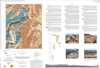
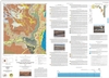
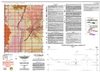
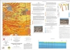
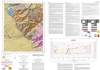
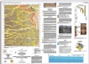
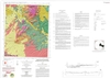
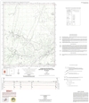
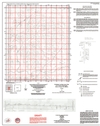
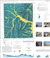
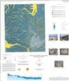
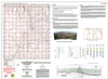
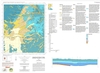
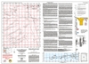
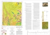
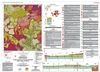
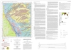
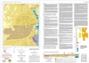
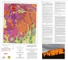
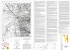
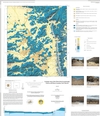
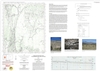
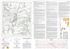
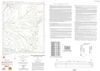
These maps are open-filed as they become available, initially as PDF files of scans of the hand-drawn linework and later as full color maps and GIS products. Following cartographic production and editorial review, these maps may be published within our GM-series or be included in larger maps of regions of particular interest.
These maps are subject to frequent revisions and may be unavailable when being revised. Map Reference dates show the time of initial compilation; Map Revision dates, when given, indicate the most current version of the map; Last Modified dates for files may not, accurately reflect the time the map was last revised.
Please direct comments or requests regarding these maps to either the map authors or the Geologic Mapping Program Manager.