


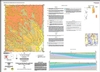
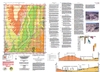
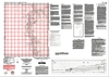
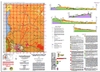
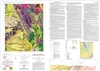
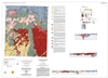
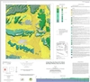
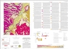
Geologic Mapping Program
Open-File Geologic Map Series (OF-GM)
Open-file Geologic Maps Listed by Map Number
Some publications, including
those that are out-of-print, are only available for purchase on CD or DVD-ROM ![]() .
.
| Stock# | Title | Price / Details |
|---|---|---|
| OF-GM-100 |
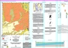
 Geologic map of the Becker 7.5-minute quadrangle, Valencia and Socorro counties, New Mexico, Luther, Amy L.; Karlstrom, Karl E.; Scott, Lea Anne; Elrick, Maya; Connell, Sean D., 2005, Scale 1:24,000, [CD/DVD-ROM on demand].
|
$10.00Buy Now
|
| OF-GM-101 |
 Geologic map of the Ojo Caliente 7.5-minute quadrangle, Rio Arriba and Taos counties, New Mexico, Koning, Daniel; Karlstrom, Karl; May, Judson; Skotnicki, Steve; Horning, Robert; Newell, Dennis; Muehlberger, William R., 2005, Scale 1:24,000, [CD/DVD-ROM on demand].
|
$10.00Buy Now
|
| OF-GM-102 |
 Geologic map of the La Joya 7.5-minute quadrangle, Socorro County, New Mexico, de Moor, Maarten; Zinsser, Austin; Karlstrom, Karl; Chamberlin, Richard; Connell, Sean; Read, Adam, 2005, Scale 1:24,000, [CD/DVD-ROM on demand].
|
$10.00Buy Now
|
| OF-GM-103 |
 Geologic map of the Chili 7.5-minute quadrangle, Rio Arriba County, New Mexico, Koning, Daniel; Skotnicki, Steve; Kelley, Shari; Moore, Jessica, 2005 (Revised: 7/16/19), Version: 2, Scale 1:24,000, [CD/DVD-ROM on demand].
|
$10.00Buy Now
|
| OF-GM-104 |
 Geologic map of the Trampas 7.5-minute Quadrangle, Rio Arriba and Taos counties, New Mexico, Bauer, Paul W.; Helper, Mark A.; Aby, Scott, 2005 (Revised: 7/23/19), 1 pages, Scale 1:24,000, [CD/DVD-ROM on demand].
|
$10.00Buy Now
|
| OF-GM-105 |
 Geologic map of the El Valle 7.5-minute quadrangle, Rio Arriba, Santa Fe, and Taos counties, New Mexico, Aby, Scott; Timmons, J. Michael, 2005, Scale 1:24,000, [CD/DVD-ROM on demand].
|
$10.00Buy Now
|
| OF-GM-106 |
 Geologic map of the Youngsville 7.5-minute quadrangle, Rio Arriba County, New Mexico, Kelley, Shari A.; Lawrence, John R.; Osburn, G. Robert, 2005, Scale 1:24,000, [CD/DVD-ROM on demand].
|
$10.00Buy Now
|
| OF-GM-107 |
 Geologic map of the Canones 7.5-minute quadrangle, Rio Arriba County, New Mexico, Kelley, Shari A.; Osburn G. Robert; Ferguson, Charles; Moore, Jessica; Kempter, Kirt, 2005, Scale 1:24,000, [CD/DVD-ROM on demand].
|
$10.00Buy Now
|
| OF-GM-108 |
 Geologic map of the Vallecitos 7.5-minute quadrangle, Rio Arriba and Sandoval counties, New Mexico, Kempter, Kirt; Kelley, Shari; Koning, Dan; Ferguson, Charles; Osburn, Bob; Fluk, Linda, 2005 (Revised: 6/23/23), Version: 2, Scale 1:24,000, [CD/DVD-ROM on demand].
|
$10.00Buy Now
|
| OF-GM-109 |
 Geologic map of the Tome SE 7.5-minute quadrangle, Valencia County, New Mexico, Rawling, Geoffrey, 2005, Scale 1:24,000, [CD/DVD-ROM on demand].
|
$10.00Buy Now
|
| OF-GM-110 |
 Geologic map of the Loma de las Cañas quadrangle, Socorro County, New Mexico, Cather, Steven; Colpitts, Robert, Jr., 2005, Scale 1:24,000, [CD/DVD-ROM on demand].
|
$10.00Buy Now
|
| OF-GM-111 |
 Geologic map of the Redondo Peak quadrangle, Sandoval County, New Mexico, Goff, Fraser; Gardner, Jamie N.; Reneau, Steven L.; Goff, Cathy J., 2005 (Revised: 1/1/06), Scale 1:24,000, [CD/DVD-ROM on demand].
|
$10.00Buy Now
|
| OF-GM-112 |
 Geologic map of the Bland quadrangle, Los Alamos and Sandoval Counties, New Mexico, Goff, Fraser; Reneau, Steven L.; Lynch, Scott; Goff, Cathy J.; Gardner, Jamie N.; Drakos, Paul; Katzman, Danny, 2005, Scale 1:24,000, [CD/DVD-ROM on demand].
|
$10.00Buy Now
|
| OF-GM-113 |
 Geologic map of the Upham Hills 7.5-minute quadrangle, Sierra County, New Mexico, Seager, William R, 2002 (Revised: 3/1/05), Scale 1:24,000, [CD/DVD-ROM on demand].
|
$10.00Buy Now
|
| OF-GM-114 |
 Geologic map of the Prisor Hill 7.5-minute quadrangle, Sierra County, New Mexico, Seager, William R, 2005, Scale 1:24,000, [CD/DVD-ROM on demand].
|
$10.00Buy Now
|
| OF-GM-115 |
 Geologic map of the Chise quadrangle, Sierra County, New Mexico, Jahns, Richard H.; McMillan, Kent; O'Brient, James D., 2006, Scale 1:24,000, [CD/DVD-ROM on demand].
|
$10.00Buy Now
|
| OF-GM-116 |
 Geologic map of the Arroyo Hondo quadrangle, Taos County, New Mexico, Kelson, Keith; Bauer, Paul, 2006, Scale 1:24,000, [CD/DVD-ROM on demand].
|
$10.00Buy Now
|
| OF-GM-117 |
 Geologic map of the King Draw quadrangle, Santa Fe County, New Mexico, Allen, Bruce, 2006, Scale 1:24,000.
|
$10.00Buy Now
|
| OF-GM-118 |
 Geologic map of the Water Canyon quadrangle, Socorro County, New Mexico, Chamberlin, Richard M.; Osburn, G. Robert, 2006, Scale 1:24,000, [CD/DVD-ROM on demand].
|
$10.00Buy Now
|
| OF-GM-119 |
 Geologic map of the Fort Stanton quadrangle,Lincoln County, New Mexico, Rawling, Geoffrey, 2006 (Revised: 8/21/20), Scale 1:24,000, [CD/DVD-ROM on demand].
(Superseded by Open-file Report-507)
Geologic map of the Fort Stanton quadrangle,Lincoln County, New Mexico, Rawling, Geoffrey, 2006 (Revised: 8/21/20), Scale 1:24,000, [CD/DVD-ROM on demand].
(Superseded by Open-file Report-507)
|
$10.00Buy Now
|
| OF-GM-120 |
 Geologic map of the Holt Mountain quadrangle, Catron County, New Mexico, Ratte, Jim; Lynch, Scott; McIntosh, Bill, 2006, Scale 1:24,000, [CD/DVD-ROM on demand].
|
$10.00Buy Now
|
| OF-GM-121 |
 Geologic map of the Abeytas quadrangle, Socorro County, New Mexico, McCraw, David J.; Love, David W.; Connell, Sean D., 2006, Scale 1:24,000, [CD/DVD-ROM on demand].
|
$10.00Buy Now
|
| OF-GM-122 |
 Geologic map of the Abreu Canyon quadrangle, Colfax County, New Mexico, Skotnicki, Steven J.; Ferguson, Charles A., 2006, Scale 1:24,000, [CD/DVD-ROM on demand].
|
$10.00Buy Now
|
| OF-GM-123 |
 Geologic map of the Alamogordo South quadrangle, Otero County, New Mexico, Romero, G.; Koning, D .J., 2006, Scale 1:24,000, [CD/DVD-ROM on demand].
|
$10.00Buy Now
|
| OF-GM-124 |
 Geologic map of the Arroyo del Agua quadrangle, Rio Arriba County, New Mexico, Kelley, S. A.; Lawrence, J. R.; Zeigler, K. E.; Osburn, G. R.; Lucas, S. G., 2006, Scale 1:24,000, [CD/DVD-ROM on demand].
|
$10.00Buy Now
|
| OF-GM-125 |
 Geologic map of the Baldy Mountain quadrangle, Colfax County, New Mexico, Ferguson, Charles A.; Skotnicki, Steven J., 2006, Scale 1:24,000, [CD/DVD-ROM on demand].
|
$10.00Buy Now
|
| OF-GM-126 |
 Geologic map of the Bottomless Lakes quadrangle, Chaves County, New Mexico (Supercedes Preliminary geologic map of the Bottomless Lakes quadrangle, Chaves County, New Mexico, May 2006), Rawling, Geoffrey; McCraw, David J., 2010, Scale 1:24,000, [CD/DVD-ROM on demand].
|
$10.00Buy Now
|
| OF-GM-127 |
 Geologic map of the Ghost Ranch quadrangle, Rio Arriba County, New Mexico, Koning, Daniel J.; Kelley, Shari; Zeigler, Kate E.; Lucas, Spencer G., 2006, Scale 1:24,000, [CD/DVD-ROM on demand].
|
$10.00Buy Now
|
| OF-GM-128 |
 Geologic map of the Jarosa quadrangle, Rio Arriba County, New Mexico, Timmer, Robert; Woodward, Lee; Kempter, Kirt; Kelley, Shari; Osburn, G. Robert; Osburn, Magdalena; Buffler, Richard; Lawrence, John Rick, 2006 (Revised: 6/21/23), Version: 2, Scale 1:24,000, [CD/DVD-ROM on demand].
|
$10.00Buy Now
|
| OF-GM-129 |
 Geologic map of the Luna quadrangle, Catron County, New Mexico, Finnell, Tommy L.; Ratte, James C., 2006, Scale 1:24,000, [CD/DVD-ROM on demand].
|
$10.00Buy Now
|
| OF-GM-130 |
 Geologic map of the Ojitos Frios quadrangle, San Miguel County, New Mexico, Horn, Marty; Timmons, J. Michael, 2006, Scale 1:24,000, [CD/DVD-ROM on demand].
|
$10.00Buy Now
|
| OF-GM-131 |
 Geologic map of the Reserve quadrangle, Catron County, New Mexico, Ratte, Jim, 2006, Scale 1:24,000, [CD/DVD-ROM on demand].
|
$10.00Buy Now
|
| OF-GM-132 |
 Geologic map of the Valle San Antonio quadrangle, Sandoval County, New Mexico, Goff, Fraser; Reneau, Steven L.; Goff, Cathy J.; Gardner, Jamie N.;Drakos, Paul G.; Katzman, Danny, 2006, Scale 1:24,000, [CD/DVD-ROM on demand].
|
$10.00Buy Now
|
| OF-GM-133 |
 Geologic map of the Valle Toledo quadrangle, Los Alamos and Sandoval Counties, New Mexico, Gardner, Jamie N.; Goff, Fraser; Reneau, Steven L.; Sandoval, Magdalena M.; Drakos, Paul G.; Katzman, Danny; Goff, Cathy J., 2006, Scale 1:24,000, [CD/DVD-ROM on demand].
|
$10.00Buy Now
|
| OF-GM-134 |
 Geologic map of the Nogal Peak 7.5-minute quadrangle, Lincoln and Otero Counties, New Mexico, Goff, Fraser; Kelley, Shari A.; Lawrence, John R.; Cikoski, Colin T.; Krier, Donothan; Goff, Cathy J.; McLemore, Virginia T., 2011 (Revised: 8/21/20), Scale 1:24,000, [CD/DVD-ROM on demand].
|
$10.00Buy Now
|
| OF-GM-135 |
 Geologic map of the Cloudcroft quadrangle, Otero County, New Mexico, Hallett, Benjamin, 2007, Scale 1:24,000, [CD/DVD-ROM on demand].
|
$10.00Buy Now
|
| OF-GM-136 |
 Geologic map of the Godfrey Peak 7.5-minute quadrangle, Lincoln and Otero Counties, New Mexico, Kelley, Shari A.; Kempter, Kurt A.; Koning, Daniel J.; Goff, Fraser; Cikowski, Colin T., 2011, Scale 1:24,000, [CD/DVD-ROM on demand].
|
$10.00Buy Now
|
| OF-GM-137 |
 Geologic map of the Bluff Springs 7.5-minute quadrangle map, Otero County, New Mexico, Hallett, Benjamin, 2006, Scale 1:24,000, [CD/DVD-ROM on demand].
|
$10.00Buy Now
|
| OF-GM-138 |
 Geologic map of the Cub Mountain 7.5-minute quadrangle, Lincoln County, New Mexico, Koning, Daniel J.; Kempter, Kurt A.; Zeigler, Kate E.; Cikoski, Colin T., 2011, Scale 1:24,000, [CD/DVD-ROM on demand].
|
$10.00Buy Now
|
| OF-GM-139 |
 Geologic map of the Rogers Ruins 7.5-minute quadrangle map, Cibola County, New Mexico, Hallett, Benjamin, 2006, Scale 1:24,000, [CD/DVD-ROM on demand].
|
$10.00Buy Now
|
| OF-GM-140 |
 Geologic map of the La Joya NW quadrangle, Socorro County, New Mexico, Connell, S. D., McCraw, D. J., 2007, Scale 1:24,000, [CD/DVD-ROM on demand].
|
$10.00Buy Now
|
| OF-GM-141 |
 Geologic map of the La Madera quadrangle, Rio Arriba County, New Mexico, Koning, D. J., Karlstrom, K. E., Salem, A., Lombardi, C., 2007, Scale 1:24,000, [CD/DVD-ROM on demand].
|
$10.00Buy Now
|
| OF-GM-142 |
 Geologic map of the Ladron Peak quadrangle, Socorro County, New Mexico., Read, Adam S.; Cather, Steve M.; Chamberlin, Richard M.; Connell, Sean D.; Karlstrom, Karl E.; Hook, Steven C., 2007, Scale 1:24,000, [CD/DVD-ROM on demand].
|
$10.00Buy Now
|
| OF-GM-143 |
 Geologic map of the Stanley quadrangle, Santa Fe County, New Mexico., Allen, Bruce, 2007, Scale 1:24,000, [CD/DVD-ROM on demand].
|
$10.00Buy Now
|
| OF-GM-144 |
 Geologic map of the Taos Junction quadrangle, Taos County, New Mexico, Koning, D. J.: Aby, S.: Kelson, K., 2007, Scale 1:24,000, [CD/DVD-ROM on demand].
|
$10.00Buy Now
|
| OF-GM-145 |
 Geologic map of the Tres Ritos quadrangle, Taos County, New Mexico, Aby, Scott; Hallet, Ben, 2007, Scale 1:24,000, [CD/DVD-ROM on demand].
|
$10.00Buy Now
|
| OF-GM-146 |
 Geologic map of the Cañon Agua Buena quadrangle, Socorro County, New Mexico, Cather, Steven M.; Osburn, G. Robert, 2007, Scale 1:24,000, [CD/DVD-ROM on demand].
|
$10.00Buy Now
|
| OF-GM-147 |
 Geologic map of the Bay Buck Peaks quadrangle, Socorro County, New Mexico, Osburn, G. R.; Ferguson, C. A., 2007, Scale 1:24,000, [CD/DVD-ROM on demand].
|
$10.00Buy Now
|
| OF-GM-148 |
 Geologic map of the Thoreau NE 7.5-Minute Quadrangle, McKinley County, New Mexico, Rawling, Geoffrey C., 2015, Scale 1:24,000, [CD/DVD-ROM on demand].
|
$10.00Buy Now
|
| OF-GM-149 |
 Geologic Map of the White Rock 7.5-Minute Quadrangle, Santa Fe, Sandoval, and Los Alamos Counties, New Mexico, Dethier, David P.; Koning, Daniel J., 2007 (Revised: 7/16/19), Version: 2, Scale 1:24,000, [CD/DVD-ROM on demand].
|
$10.00Buy Now
|
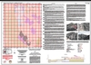
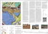
Notes:
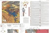
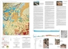
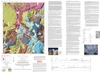
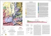
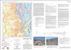
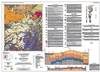
These maps are open-filed as they become available, initially as PDF files of scans of the hand-drawn linework and later as full color maps and GIS products. Following cartographic production and editorial review, these maps may be published within our GM-series or be included in larger maps of regions of particular interest.
These maps are subject to frequent revisions and may be unavailable when being revised. Map Reference dates show the time of initial compilation; Map Revision dates, when given, indicate the most current version of the map; Last Modified dates for files may not, accurately reflect the time the map was last revised.
Please direct comments or requests regarding these maps to either the map authors or the Geologic Mapping Program Manager.