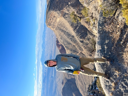
Jon M. Krupnick
Jump To:

New Mexico Bureau of Geology & Mineral Resources
New Mexico Institute of Mining & Technology
801 Leroy Place
Socorro NM 87801-4796
575-835-5151
(575) 835-6333 fax
As a field geologist (bedrock mapper) with the New Mexico Bureau of Geology and Mineral Resources, I map and conduct research throughout the state. I am most interested in geomorphology, sedimentary processes & stratigraphy, and structural geology & tectonics. Currently I am working on mapping the Carlsbad 30x60-minute sheet. I recently finished up work on the Llaves 15' quadrangle, a landslide complex in the Coyote Canyon 15' quadrangle, and helping with a portion of the Socorro 30'x60' quadrangle. I am excited to continue mapping in a variety of geologic terranes and developing my knowledge as an early career earth scientist. I am fascinated by all things related to the natural world and love to hike/explore, ski, and whitewater kayak in my free time. I grew up in western North Carolina, earned my undergraduate degree at Lehigh University in Pennsylvania, and worked my first job at the Wyoming State Geological Survey before moving to Socorro in January 2023. I am also a part time graduate student pursuing an M.S. in Geology at the New Mexico Institute of Mining and Technology working with Dr. Veronica Prush on a project relating to the Quaternary geomorphology of the Fra Cristobal Range.
(See Jon Krupnick Curriculum Vitae July 2024)
Education
Part time graduate student pursuing M.S. in Geology (expected Summer 2027), New Mexico Institute of Mining and Technology
B.S. in Earth and Environmental Science, 2021, Lehigh University
Experience
Field Geologist (Bedrock Mapper) - New Mexico Bureau of Geology and Mineral Resources - February 2023 to present
Contract Geologist - Wyoming State Geological Survey - June 2021 to December 2022
Skills
ASBOG Geologist-In-Training (G.I.T.)
First Aid and CPR Certified (pending re-certification)
Memberships
New Mexico Geological Society
Projects
Lava 7.5-minute quadrangle (1:24,000 scale) - upcoming mapping project covering portions of the Fra Cristobal Range, Palomas Basin, and Jornada Del Muerto Basin.
Crocker 7.5-minute quadrangle (1:24,000 scale) - upcoming mapping project covering portions of the Fra Cristobal Range, Palomas Basin, Cutter Sag, and Jornada Del Muerto Basin.
Carlsbad 30 x 60-minute quadrangle (1:100,000 scale) - mapping and compiling a geologic map at 1:100,000-scale. Includes Permian stratigraphy, older Paleozoic in subsurface, karst collapse features of Cretaceous rocks, Oligocene intrusives, Neogene lag gravels, and extensive Quaternary history with alluvial, eolian, and lacustrine deposition. Especially interested in the chronology of piedmont alluvium tributary deposits and their relation to the ancestral and modern Pecos River, the formation of the Mescalero Paleosol after the end of Gatuna Formation deposition, and entrenchment of the modern Pecos River. This area includes portions of the Delaware Basin, Guadalupe Mountains, Brokeoff Mountains, and Salt Basin.
Llaves 15-minute quadrangle (1:62,500 scale) - mapping of Permian, Triassic, Jurassic, Cretaceous, and Paleogene stratigraphy as well as Quaternary surficial deposits. Interested in the river terraces of the Rio Gallina, stream captures in high order tributaries, and the tectonic implications of its integration into the Rio Chama. This quadrangle is found along the eastern margin of the San Juan Basin in the Gallina-Archuleta arch north of Sierra Nacimiento.
Coyote Canyon 15-minute quadrangle (1:62,500 scale) - mapping significant landslide complex disrupting Cretaceous and Eocene-Oligocene stratigraphy in the southwestern Chuska Mountains as well as subsequent and concurrent alluvial and eolian deposits.
Socorro 30 x 60-minute quadrangle (1:100,000 scale) - mapping and compiling a portion of this quadrangle on the western edge of the Chupadera Mesa. Mapping included Permian and Triassic stratigraphy as well as Cenozoic intrusives and Quaternary surficial deposits.
Publications
(See Jon Krupnick Curriculum Vitae July 2024 for more details)
*denotes conference abstract
*Hobbs, K.M., Krupnick, J.M., (2024), Evolution of the Chuska Mountain Front, Navajo Nation, New Mexico: Constraints from Geomorphic Relationships, Mapping, and Geochronology. Geological Society of America Abstracts with Programs. Vol. 56, No. 4 2024, doi: 10.1130/abs/2024CD-399538
*Krupnick, J.M., Hobbs, K.M., Martin, L., (2023), A Cryptic Miocene Occurrence of an Ultramafic Dike in the Interior of the San Juan Basin: Composition, Age, and Tectonic Interpretations. 2023 New Mexico Geological Society Annual Spring Meeting, doi:10.56577/SM-2023.2912
Lichtner, D.T., Krupnick, J.M., Doorn, C.J., Webber, P.M., 2023, Critical-Mineral-Bearing Paleoplacers in the Basal Cambrian Flathead Sandstone and other Radioactive Conglomerates, Wyoming: Geochemistry and Minerology: Wyoming State Geological Survey Open File Report 2023-2, 58 p., https://doi.org/10.15786/24279697
Lichtner, D.T., Krupnick, J.M., Webber, P.M., and Doorn, C.J., 2023, Upper Cretaceous fossil beach placers of Wyoming—Geochemistry, mineralogy, and economics: Wyoming State Geological Survey Report of Investigations 80, 97 p., https://doi.org/10.15786/24279688.
Mauch, J.P., Wittke, S.J., and Krupnick, J.M., 2023, Preliminary surficial geologic map of the west half of The Ramshorn 30' x 60' quadrangle, Fremont and Park counties, Wyoming: Wyoming State Geological Survey Open File Report 2023-1, 34 p., scale 1:100,000, https://doi.org/10.15786/22770890.
Webber, P.M., Lynds, R.M., Stotter, S.V., and Krupnick, J.M., 2022, Preliminary investigation of the critical mineral potential of the central Laramie Mountains, Wyoming: Wyoming State Geological Survey Report of Investigations 79, 86 p. https://doi.org/10.15786/21222374
Lichtner, D.T., and Krupnick, J.M., 2022, Preliminary geologic map of the Oil Mountain quadrangle, Natrona County, Wyoming: Wyoming State Geological Survey Open File Report 2022-3, 34 p., scale 1:24,000.
Presentations
New Mexico Geological Society Spring Meeting 2023 - Poster: A Cryptic Miocene Occurence of an Ultramafic Dike in the Interior of the San Juan Basin: Composition, Age, and Tectonic Interpretations
Jon M Krupnick Curriculum Vitae June 2024
| Name | Size | Last Modified |
|---|---|---|
| ./documents/ 📂 | ||
| Jon Krupnick Curriculum Vitae July 2024.pdf | 447 KB | 07/01/2024 09:22:53 AM |


