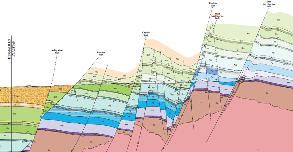
Image of the Day — West - East Cross Section of the Placitas Quadrangle.
Posted: Tuesday, October 1, 2024

Lighter shading above the ground surface (dark line) shows projected and inferred stratigraphy.
©
1995
New Mexico Bureau of Geology and Mineral Resources
Longitude: -106.424747
Latitude: 35.306984
(WGS 84 or NAD 83)
About this image
This West - East cross section of the northern part of the Sandia Mountains shows some of the complexity of of the rift margin in the Albuquerque basin. The Sandia Mountains are a classic rift-flank uplift formed by isostatic rebound following normal faulting along the Rio Grande rift.
for more information, see:
Sean D. Connell, Steve M. Cather, Bradley Ilg, Karl E. Karlstrom, Barbara Menne, Mark Picha, Chris Andronicos, Adam S. Read, Paul W. Bauer, and Peggy S. Johnson, 1995, 1:24:000
[See more information related to this image...]
Image posted: 12-17-2021


