


Circular 149—Geology of Potrillo basalt field, south-central New Mexico
We are a research and service division of:
By J. M. Hoffer, 1976, 30 pp., 11 tables, 12 figs., 1 sheet.
Detailed geologic investigations of the 500 mi2 comprising the basalt field situated principally in southwestern Doña Ana County. The region of investigation covers over 500 mi2 in southwestern Doña Ana County and a part of eastern Luna County, New Mexico, located about 40 mi west and northwest of El Paso, Texas and 20 mi southwest of Las Cruces, New Mexico. The study area is bounded on the north by the Southern Pacific Railroad tracks, on the east by the New Mexico meridian, on the west by a line seven mi west of the West Potrillo Mountains, and on the south by the international boundary between the U.S. and Mexico.
Physiographically, this region is located in a major intermontane basin, the Mesilla Bolson, which is part of the Mexico Highland section of the Basin and Range province. The basin surface of middle Pleistocene age has been designated the La Mesa surface. Major features of the region consist of Quaternary volcanoes and associated lava flows, a westward dipping fault-block mountain range, and a number of small hills of intrusive igneous rock. This report was prepared from geological studies of the area completed by J. M. Hoffer, C. J. Callahan, R. O. Page, and R. S. Millican from 1970 to 1974.
During June and July 1970 Millican mapped and studied the petrography of the intrusive masses of the Mt. Riley region in conjunction with a master's thesis in the Department of Geological Sciences, University of Texas at El Paso. Callahan, also a geology graduate student at the same institution, investigated the geology of the East Potrillo Mountains during the months of August, September, and October 1970. During the summer of 1971, Callahan studied the surface features of the basalt near Aden as part of a master's thesis at the University of Texas at El Paso. The geology of Malpais volcano in the West Potrillo Mountains was studied by Page as a University of Texas at El Paso master's thesis. Hoffer mapped and studied the petrography of the volcanic rocks, investigated economic geology of the area, and directed the project.
The purpose of the investigation was to prepare a more detailed geological map than was previously available for the area with special emphasis on determining the major volcanic units and their relationships, reexamining the sedimentary units of the East Potrillo Mountains, determining the nature and composition of the igneous rocks in and around the Mt. Riley-Mt. Cox hills, and evaluating the economic resources of the area. Mapping was done on Army Map Service aerial photographs at scales 1:55,500 and 1:18,500. Data were transferred to U.S. Geological Survey topographic maps for preparation of the geologic map. Classification of rock types, both igneous and sedimentary, was determined by examination of over 300 thin sections.
The Potrillo Basalt field is situated principally in southwestern Doña
Ana County, New Mexico. Strata ranging from Paleozoic to Holocene are exposed
in the area. Marine sediments, chiefly carbonates, were deposited during
repeated advances and withdrawals of late Paleozoic and early Mesozoic seas.
Throughout the Cenozoic the area was above sea level and experienced periods
of volcanism, erosion, and deposition of continental material. Folding and
faulting of Lower Cretaceous strata occurred during the Laramide disturbance
in the East Potrillo Mountains. In the early to middle Tertiary a large
andesitic pluton, Mt. Riley-Mt. Cox, was emplaced northwest of the East
Potrillo Mountains. Closely associated with this activity was the intrusion
of the andesite and quartz latite dikes of the East Potrillo Mountains,
and small intrusive plugs adjacent to Mt. Riley. During middle Tertiary,
high-angle faulting and uplift occurred in the East Potrillo Mountains and
initiated the formation of intermontane basins such as the Mesilla Bolson.
Basin-fill deposits of late Tertiary to early Quaternary are termed the
Santa Fe Group. These include a stream channel and flood-plain facies and
a lacustrine-playa facies. During middle to late Quaternary, alkali olivine
basalt was extruded. The basalt was erupted from fissures associated with
Fitzgerald, Robledo, and Aden faults. The basalt of the Aden-Afton region
is situated in a graben, whereas those of the West Potrillo Mountains are
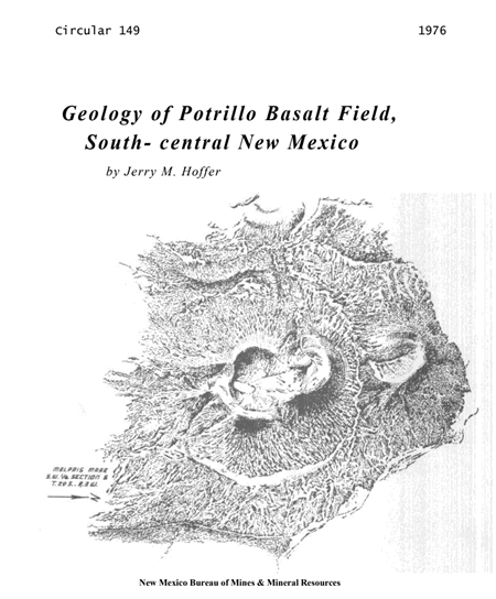
on a horst. Numerous volcanoes occur in the volcanic field; they include
such types as cinder, explosive, maar, and shield. Late Pleistocene to Holocene
movement is evident along many of the major faults such as the Robledo and
Fitzgerald faults. Holocene deposits, which cover large areas of basalt
and the Santa Fe sediments, consist mainly of fine blown sand and minor
playa deposits.
$6.00
Buy
Now
Also available as a free download.
Download
| File Name | Size | Last Modified |
|---|---|---|
| Circular-149.pdf | 3.00 MB | 01/11/2021 02:59:03 PM |