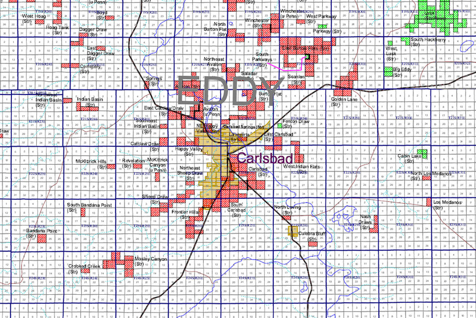
Image of the Day — Southeast Strawn Pool Map
Posted: Sunday, January 5, 2025

Strawn oil (green) and gas (red) pools in the Carlsbad area
Longitude: -104.228837
Latitude: 32.420674
(WGS 84 or NAD 83)
About this image
In New Mexico, oil and gas pool names have both a geographic and a stratigraphic component (e.g. Bisti Gallup). The first part of the pool name is the field name and is usually derived from the geographic location of the the pool (e.g. Bisti). The second part of the pool name is the stratigraphic name and is derived from the stratigraphic unit that produces the oil or gas (e.g. Gallup). Because of this system of pool nomenclature, pool boundaries may overlap where production in an area is obtained from more than one stratigraphic unit. Therefore, the oil and gas pool maps are organized stratigraphically. There are currently 21 maps in NW New Mexico and 24 maps in SE New Mexico. Oil and gas pool boundaries indicated on these maps are the legal boundaries of the pools as provided by the New Mexico Oil Conservation Division.
Circular 209 provides both GIS data and PDF versions of these pool maps.
[See more information related to this image...]
Image posted: 12-17-2021


