


Circular 179—Porosity of lower part of San Andres Formation, east-central New Mexico
We are a research and service division of:
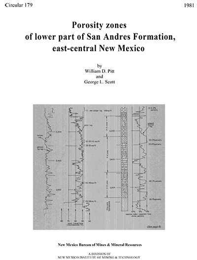
By W. D. Pitt and G. L. Scott, 1981, 19 pp., 1 table, 22 figs.
This report is concerned with the lithologic variations within the lower part of the San Andres Formation in east-central New Mexico and the relationships of these variations to the potential occurrence of oil and gas. This report presents a detailed lithologic analysis of the lower part of the San Andres Formation (Permian), located on the northwest shelf of the Permian Basin. Included are lithofacies, isopach, structure, and porosity maps and three regional cross sections. The San Andres Formation for many years has been a primary objective in the search for oil and gas in eastern New Mexico and in west Texas. Thus, this report should prove useful in planning future petroleum exploration programs for the San Andres Formation in east-central New Mexico.
The lower part of the San Andres Formation in east-central New Mexico consists
of three cyclic zones, commonly known as the P-3, P-4, and P-5 porosity
zones. Each of these typically consists of a thin, widespread evaporite
at the top, carbonate rocks in the middle, and a thin, shaly carbonate-rock
zone at the base. Locally, halite may replace anhydrite. Most of each zone
consists of carbonate rocks, and dolomite normally underlies the upper anhydrite
and may be more than one hundred ft thick. The dolomite may contain one
or more layers of anhydrite and in most places is underlain by limestone.
Lithofacies studies of the lower San Andres indicate that where the carbonate
rock consists entirely of dolomite, an above-average amount of evaporites
is present. Lithofacies studies also indicate that porosity trends are mappable
and such studies help to determine favorable areas for petroleum exploration.
The lower San Andres of east-central New Mexico was deposited along a north-
to northeast-trending coastal area that prograded southward and eastward,
except during the deeper-water beginning of each cycle, when shale or limestone
normally was deposited. The northern and western limit of traceable San
Andres zones appears to be a gradational facies boundary where the San Andres
becomes more evaporitic. Porosity in the older P-4 and P-5 zones persists
farther north than in the P-1, P-2, and P-3 zones, demonstrating the general
southward shift of facies with time.
$6.25
Buy
Now
Also available as a free download.
Download
| File Name | Size | Last Modified |
|---|---|---|
| Circular-179.pdf | 6.20 MB | 01/11/2021 03:39:18 PM |