


New Mexico Geological Society
Fall Field Conference Guidebook - 52
Geology of Llano Estacado
We are a research and service division of:
Spencer G. Lucas and Dana Ulmer-Scholle, eds, 2001, 340 pages.
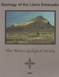
The history of geological studies in New Mexico began on 22 September 1853 when Swiss geologist Jules Marcou (1824-1898) climbed a hill about 20 km southwest of what is now Tucumcari. Dubbed by Marcou "Pyramid Mountain," this hill exposes red beds at its base, overlain by cliffs of yellow sandstone and capped by a thin shale interval from which poured shells of marine bivalves. Marcou identified these bivalves as the oyster-like Gryphaea (they actually pertain to a closely related genus, subsequently named Texigryphaea), and assigned them a Jurassic age. He thus concluded that the High Plains surface here, and throughout the region, is underlain by Jurassic strata. But the bivalves and the rocks that contain them are actually Cretaceous in age, and Marcou's mistake engendered the first scientific debate about the geology of New Mexico, one that was not resolved during his lifetime. This year, nearly 150 years after Marcou's visit, the attendees of the 52nd Field Conference of the New Mexico Geological Society will visit Pyramid Mountain. And, although the mountain has not changed much since Marcou, our understanding of the rocks exposed on its flanks has, and is a major focus of the field conference and this guidebook. The first day's trip takes us across part of the Llano Estacado to examine Permian, Triassic, Jurassic, Cretaceous and Neogene sedimentary rocks exposed at its margins. In so doing we review the entire section exposed around the staked plains, focusing on problems of stratigraphy, sedimentation, biostratigraphy and magnetostratigraphy. The second day begins by examining Mesozoic strata exposed around erosional outliers of the northern edge of the Llano Estacado in Quay County. The second stop will be to Pyramid Mountain. We will also examine excellent expsoures of the Ogallala Formation at Stop 3. On the final day we will explore the geology of the Canadian River drainage from Tucumcari north to Conchas Dam. Here we contrast differences between the beginning and end of the Late Triassic deposition in the vast Chinle Basin, and the continuity of Middle Jurassic eolian deposition across the American Southwest.
Papers from this guidebook are available for download from the NMGS website.
ISBN: 9781585460878
Softcover:
$5.00
Buy
Now
Individual papers from this guidebook are available as free downloads from the NMGS site.