
City of Rocks State Park
modified from McLemore, V.T., 1997, City of Rocks State Park: New Mexico Geology, v. 19, p. 44-47.
Introduction
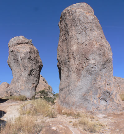
City of Rocks State Park is truly a geologic monument; it is formed by large sculptured rock columns (pinnacles) or boulders rising as high as 40 ft and separated by paths or lanes resembling city streets (Figures 1 and 2). About 34.9 million years ago a large volcano erupted, forming the rocks in an instant (geologically speaking); then erosion over millions of years slowly formed the sculptured columns that now provide a natural playground for children and adults alike. City of Rocks State Park was established in May 1952 to preserve this geologic wonder.
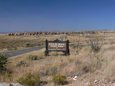
City of Rocks State Park is in the Mimbres Valley of the Chihuahuan Desert, and typical desert vegetation abounds. Mimbres is Spanish for willow. Yuccas, cacti, ocotillo, and juniper and evergreen oak trees are common in the park. The botanical garden near the entrance contains common and exotic species of desert plants, especially cacti. After a wet winter or after a rainstorm, wildflowers abound. The park is also home to many animals. At least 35 species of birds call this rock city their home, including bald eagles, golden eagles, hawks, horned owls, cactus wrens, roadrunners, and finches. Many of these birds live in cavities and crevasses in the rocks. Watch your campground carefully because ground squirrels, chipmunks, rabbits, or pack rats may invade and eat your supplies. Reptiles (rattlesnakes and lizards) and scorpions are also residents of City of Rocks, so keep young children close at hand.
Geology
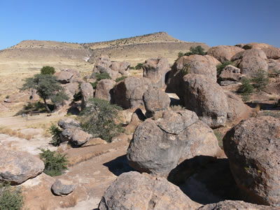
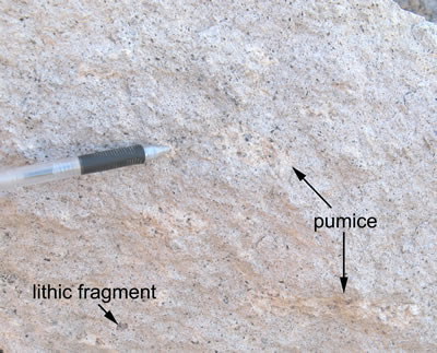
The rocks forming City of Rocks are predominantly ash-flow tuffs or ignimbrites that formed by a violent volcanic eruption of pumice, volcanic ash, gas, and coarser material. The ash-flow tuff at City of Rocks is part of the Kneeling Nun Tuff, which erupted 34.9 million years ago from the Emory caldera (McIntosh et al., 1991). The Emory caldera forms much of the southern Black Range east of the park. The volcanic ash was still hot and nearly molten when it was compacted and consolidated, forming a horizontal continuous layer of hot pumice and ash. In many areas, the ash fragments in the layer were hot enough to compact and weld together, forming the solid lava-like rock exposed at the park. Cooling and contraction of the tuff formed a pattern of vertical cracks called columnar jointing; these features can be seen in the cliffs forming Table Mountain, northeast of City of Rocks (Figure 4). For a more detailed explanation of the plate tectonic setting of this area, check out the Gila Cliff Dwellings National Monument webpage.
The Kneeling Nun Tuff represents only one of dozens of huge ash-flow tuff eruptions that occurred between 36 and 24 million years ago in southwest New Mexico. Many of these eruptions were larger than any eruptions known from recorded human history; the Kneeling Nun Tuff eruption was more than one thousand times larger than the 1980 eruption of Mt. St. Helens. Three other ash-flow tuffs, ranging in age from 34.4 to 33.4 million years (McIntosh et al., 1991), are exposed on the slopes of Table Mountain, immediately north of City of Rocks State Park (Figure 4). The source calderas for some of these ash-flow tuffs were south of Lordsburg, N.M.
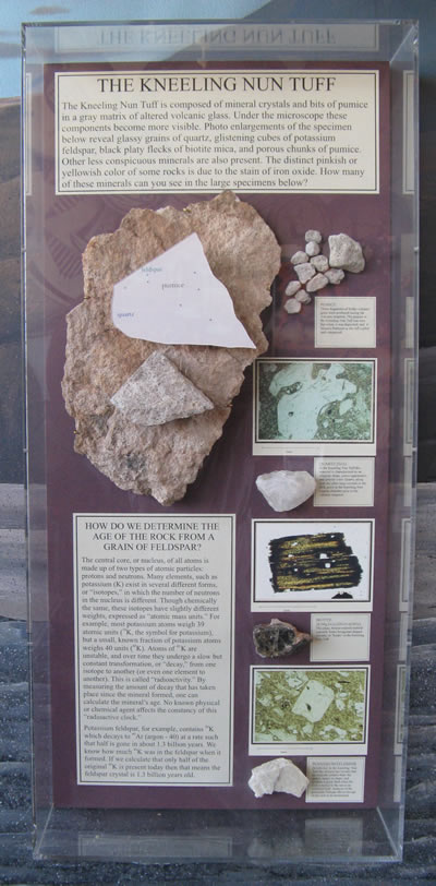
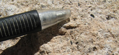
The ash-flow tuff that forms City of Rocks is of rhyolite composition. A close look will reveal phenocrysts or mineral grains surrounded by a finer groundmass or matrix (Figures 5 and 6). The shiny, black laths are hornblende crystals. The platey black crystals are biotite. The grayish-white to clear rounded crystals are quartz. White to clear, glassy laths or cubes are feldspar crystals. The matrix is too fine grained to be seen with the naked eye, but a microscope reveals that it is comprised of small grains of pumice (volcanic glass or ash), feldspar, quartz, and hornblende.
Some of the larger, clearer feldspar crystals are potassium-rich sanidine, an ideal mineral for dating with the 40Ar/39Ar method (Figure 3). Very precise ages have been determined for ash-flow tuffs in the City of Rocks area by using a CO2 laser to melt single sanidine crystals and release argon gas, then measuring argon isotopes in a mass spectrometer (McIntosh et al., 1991). These ages range from 35.2 million years for an ashy sandstone beneath the Kneeling Nun Tuff to 33.4 million years for the ash-flow tuff that forms the top of Table Mountain. The precise age determinations help in understanding the history of this sequence of rocks, originally mapped as Sugarlump Tuff by Elston (1957) and Seager et al. (1982).
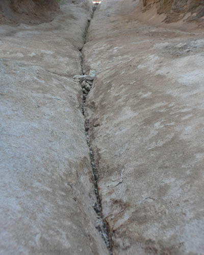
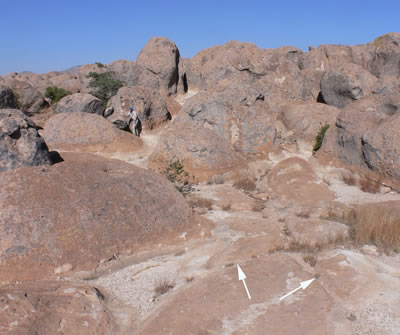
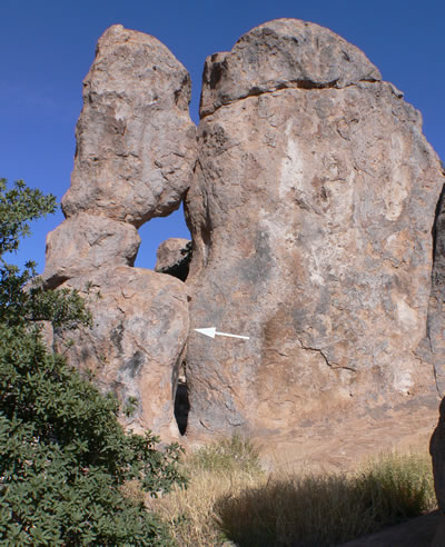
The “streets” in City of Rocks are formed by orthogonal fractures (Figures 7, 8, and 9) Mueller and Twidale, 1988a, b). More than one mechanism formed the fractures that trend north-northeast, east-northeast, and northwest (Mueller and Twidale, 1988a, b). Some fractures may be columnar jointing formed as a result of cooling; others may be associated with the release of gravitational load as younger overlying rocks were eroded (Mueller and Twidale, 1988a, b). Some fractures may have formed during erosion.
Weathering of the ash-flow tuff at City of Rocks, in part by freeze-thaw action and wind, formed the rocks as we now see them. Water seeps into the cracks, expands upon freezing, and widens the crack. Vegetation grows in the cracks and further widens the crack. Wind removes the finer-sized material. Although the surficial weathering processes are important, the difference in shape and color of the rocks from an upper steep-sided dark gray to a lower flared cream to reddish brown suggests that much of the weathering occurred in the subsurface (Mueller and Twidale, 1988a, b). Subsurface weathering by water and humic acids in the soil horizon slowly dissolved and eroded the rocks, forming the flared bottoms. Several periods of weathering occurred as evidenced by multiple flares. The combination of freeze-thaw, vegetation, wind, and surface and subsurface weathering over millions of years finally produced the landforms known today as City of Rocks. Surface runoff has stripped the former soil mantle and revealed the bare rock below. The rocks at City of Rocks are actually columns or pinnacles because they have weathered in place and have not been moved. Boulders are detached blocks of rocks that gravitational forces have moved.
References
- Elston, W. E., 1957, Geology and mineral resources of the Dwyer quadrangle, Grant, Luna, and Sierra Counties, New Mexico: New Mexico Bureau of Mines and Mineral Resources, Bulletin 37, 86 pp.
- Julyan, R., 1996, Place names of New Mexico: University of New Mexico Press, Albuquerque, 385 pp.
- McIntosh, W. C., Kedzie, L. L., and Sutter, J. F., 1991, Paleomagnetism and 40Ar/39Ar ages of ignimbrites, Mogollon-Datil volcanic field, southwestern New Mexico: New Mexico Bureau of Mines and Mineral Resources, Bulletin 135, 79 pp.
- McLemore, V. T., 1996, Copper in New Mexico: New Mexico Geology, v. 18, pp. 25–36.
- Mueller, J. E., and Twidale, C. R., 1988a, Geomorphic development of City of Rocks, Grant County, New Mexico: New Mexico Geology, v. 10, pp. 73–79.
- Mueller, J. E., and Twidale, C. R., 1988b, Landform development of City of Rocks State Park and Giant of the Mimbres; in Mack, G. H., Lawton, T. F., and Lucas, S. G. (eds.), Cretaceous and Laramide tectonic evolution of Southwestern New Mexico: New Mexico Geological Society, Guidebook 39, pp. 185–190.
- Seager, W. R., Clemons, R. E., Hawley, J. W., and Kelley, R. E., 1982, Geology of the northwest part of Las Cruces 1° x 2° sheet, New Mexico: New Mexico Bureau of Mines and Mineral Resources, Geologic Map GM-53, scale 1:250,000.
- Weber, R. H., 1980, City of Rocks: New Mexico Geology, v. 2, pp. 10–11.


