


GM-23 — Reconnaissance Geologic Map of the Pelona Thirty-minute Quadrangle
We are a research and service division of:
By Max E. Willard and Charles E. Stearns, 1971, lat 33°30' to 34°, long 108° to 108°30', scale 1:126,720.
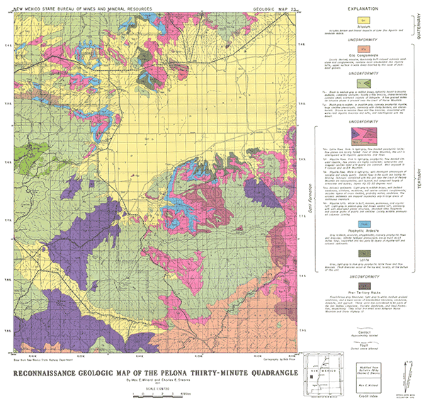
The Pelona 30-minute quadrangle contains the southwestern arm of the San Agustin Plains and surrounding highlands, which are mainly composed of Tertiary volcanic rocks of the Datil Formation. Portions of this map were modified from Bulletin-78 by Charles E. Stearns.
Related 30-minute geologic maps of this region include:
- GM-1 — Hillboro Peak
- GM-2 — Luera Spring
- GM-3 — Piñonville
- GM-5 — Datil
- GM-6 — Cañon Largo
- GM-10 — Mogollon
- GM-12 — Reserve
- GM-13 — Alum Mountain
- GM-14 — Las Cruces
- GM-15 — Virden
$4.00
Buy
Now
Also available as a free download.
Download
| File Name | Size | Last Modified |
|---|---|---|
| GM-23_map.pdf | 6.45 MB | 02/05/2021 02:58:22 PM |
| TIFF: | ||
| GM-23_map-pal.tif | 13.64 MB | 09/18/2018 09:02:47 AM |
| GM-23_map.tif | 77.40 MB | 09/18/2018 08:56:18 AM |