


GM-6 — Reconnaissance Geologic Map of Cañon Largo Thirty-minute Quadrangle
We are a research and service division of:
By Max E. Willard and Robert H. Weber, 1958, scale 1:126,720.
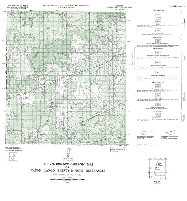
This map is centered on US-60 from Quemado to the Arizona state line. The oldest rocks exposed are Triassic Chinle Formation (now Group), which is overlain by Cretaceous sediments, Tertiary sediments, volcaniclastics, and volcanic rocks. Numerous basaltic cones and necks erupted Quaternarly basalts. The Gila conglomerate also extends into the southern portion of the mapped area.
Related 30-minute geologic maps of this region include:
- GM-1 — Hillboro Peak
- GM-2 — Luera Spring
- GM-3 — Piñonville
- GM-5 — Datil
- GM-10 — Mogollon
- GM-12 — Reserve
- GM-13 — Alum Mountain
- GM-14 — Las Cruces
- GM-15 — Virden
- GM-23 — Pelona
$3.00
Buy
Now
Also available as a free download.
Download
| File Name | Size | Last Modified |
|---|---|---|
| GM-6_map.pdf | 6.85 MB | 02/05/2021 02:48:47 PM |
| TIFF: | ||
| GM-6_map-pal.tif | 6.27 MB | 09/20/2018 09:55:58 AM |
| GM-6_map.tif | 42.51 MB | 09/20/2018 09:54:56 AM |