


GM-10 — Reconnaissance Geologic Map of Mogollon Thirty-minute Quadrangle
We are a research and service division of:
By Robert H. Weber and Max E. Willard, 1959, scale 1:126,720.
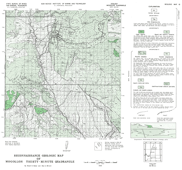
This map covers the San Francisco River and surrounding highlands in the region surrounding Glenwood, New Mexico, including the Mogollon mining district. Tertiary igeneous rocks compose most of the mapped area which are overlain by extensive deposits of the Gila Conglomerate.
Related 30-minute geologic maps of this region include:
- GM-1 — Hillsboro Peak
- GM-2 — Luera Spring
- GM-3 — Piñonville
- GM-5 — Datil
- GM-6 — Cañon Largo
- GM-12 — Reserve
- GM-13 — Alum Mountain
- GM-14 — Las Cruces
- GM-15 — Virden
- GM-23 — Pelona
$3.00
Buy
Now
Also available as a free download.
Download
| File Name | Size | Last Modified |
|---|---|---|
| GM-10_map.pdf | 7.72 MB | 02/05/2021 02:49:38 PM |
| TIFF: | ||
| GM-10_map-pal.tif | 6.77 MB | 09/19/2018 03:01:15 PM |
| GM-10_map.tif | 45.80 MB | 09/19/2018 02:59:52 PM |