


GM-2 — Reconnaissance Geologic Map of Luera Spring Thirty-minute Quadrangle
We are a research and service division of:
By Max E. Willard, 1957, scale 1:126,720.
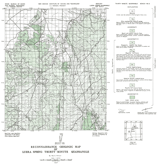
This map extends from the southern end of the San Agustin Plains southeastward into the highlands of the Gila National Forest. Most of the mapped area is covered by Tertiary sediments, volcaniclastics, and volcanic rocks which are overlain by the Gila Conglomerate.
Related 30-minute geologic maps of this region include:
- GM-1 — Hillsboro Peak
- GM-3 — Piñonville
- GM-5 — Datil
- GM-6 — Cañon Largo
- GM-10 — Mogollon
- GM-12 — Reserve
- GM-13 — Alum Mountain
- GM-14 — Las Cruces
- GM-15 — Virden
- GM-23 — Pelona
$3.00
Buy
Now
Also available as a free download.
Download
| File Name | Size | Last Modified |
|---|---|---|
| GM-2_map.pdf | 5.48 MB | 02/05/2021 02:47:15 PM |
| TIFF: | ||
| GM-2_map-pal.tif | 5.53 MB | 09/20/2018 11:59:32 AM |
| GM-2_map.tif | 39.28 MB | 09/20/2018 11:58:43 AM |