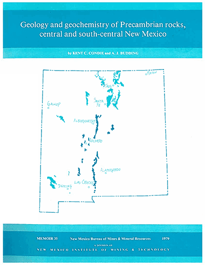
Memoir 35—Geology and geochemistry of Precambrian rocks, central and south-central New Mexico
By K. C. Condie and A. J. Budding, 1979, 60 pp., 13 tables, 48 figs., 4 appendices (3 on microfiche), 3 geologic maps (scale 1:125,000), 1 index.

Summarizes existing field, stratigraphic, petrographic, and geochronologic data from Precambrian terranes: evaluates major- and trace-element data for principal rock types in terms of alteration, models for magma origin, and sediment provenance. Also discusses origin and tectonic setting of Precambrian terrane.
The Precambrian terrane in central and south-central New Mexico is composed of granitic plutons (70 %) intruded into metamorphic rocks (30 %). The principal metamorphic rock types are phyllite and quartz-mica schist (40 %), quartzite and arkosite (30%), mafic meta-igneous rocks (15%), siliceous meta-igneous rocks (10%), and gneisses (5%). The basement rocks upon which the section was deposited have not been found. The thickest preserved sections (10–13 km) occur in the northern Manzano and central San Andres Mountains. Granitic rocks range from granodiorite to syenite in composition, with quartz monzonite predominant. Individual plutons are syntectonic to post-tectonic and have been emplaced at depths less than 10 km. Foliation strikes north-northwest to north-northeast, and the only large fold exposed in the region is a syncline in the southern Manzano Mountains. In many areas evidence exists for at least two major periods of Precambrian deformation. Metamorphic rocks range in grade from the lower greenschist to the amphibolite facies. Geochemical model studies suggest that the Precambrian tholeiites were produced by partial melting of lherzolite in the upper mantle and that the granitic rocks were produced by partial melting of siliceous granulites in the lower crust. Magmatism and sedimentation began by 1.7 b. y. ago; major plutonism, deformation, and regional metamorphism occurred between 1.0 and 1.5 b. y. ago. The Precambrian rock association in central and south-central NewMexico bears a resemblance to associations found in young continental rift systems. A model of an evolving multiple-rift system that developed in response to an ascending mantle plume or plumes is proposed for this region between 1.0-1.9 b. y. ago. Basaltic magmas are derived directly from the plume; extensive heating of the lower crust produces granitic magmas. Quartzite-arkosite-shale successions are deposited in subsiding rift basins by the erosion of nearby uplifted blocks. Precambrian rocks exposed in the cores of the principal mountain ranges in New Mexico and west Texas are among the few surface exposures of three Precambrian crustal provinces extending across the central United States. Rb-Sr-whole rock-isochron and U-Pb-zircon dates in the range of 1.65-1.9 b. y. define a province extending from southern California and Sonora to Wisconsin. Dates between 1.2-1.65 b. y. suggest the existence of another province extending from central New Mexico to Illinois south of and partially overlapping the 1.65-1.9 b. y. province. Existing data also indicate the presence of a third province extending from west Texas possibly as far east as Ohio, characterized by 1.0-1.3 b. y. dates. This report synthesizes and interprets available geologic and geochemical data from exposed Precambrian rocks in central and south-central NewMexico. The rocks studied represent the principal exposures of the 1.2-1.65 b. y. province.
From oil tests penetrating the Precambrian basement in west Texas and eastern NewMexico and from surface exposures of Precambrian rock, basement terranes can be characterized by specific rock types or rock associations. Existing data from surface exposures and from some well data in the remainder of New Mexico suggest that most of the state is underlain by a terrane composed of granitic (70%) and low- to medium-grade metamorphic rocks (30%). Basement terranes in New Mexico are shown. Most of the area covered by this report is underlain by the granitic-metamorphic terrane. The southeastern area is underlain by clastic sediments of the De Baca terrane, which is locally intruded by the Pajarito syenite complex northeast of Alamogordo. The Franklin Mountains igneous terrane may underlie a small area along the southeastern border; its relationship to the De Baca terrane is unknown.
The largest exposure of Precambrian rocks in central and south-central NewMexico occurs in the core and along the western escarpment of the Sandia, Manzanita, Manzano, and Los Pinos Mountains south of Albuquerque. This exposure, bounded by young high-angle normal faults on the west (adjacent to the Rio Grande rift) and by high-angle Laramide thrusts and/or the Phanerozoic unconformity on the east, will be referred to here as the SMP block. The block is characterized by a northeast-striking section of phyllite-schist, quartzite, and siliceous and mafic meta-igneous rocks metamorphosed to the upper greenschist or lower amphibolite facies. The Phanerozoic unconformity is best exposed along the crest of the Sandia Mountains and in the vicinity of Bosque Peak in the Manzano Mountains. At these locations, the Sandia Formation (Pennsylvanian) overlies the Precambrian rocks. The Precambrian section is intruded by one pretectonic or syntectonic granitic pluton (the Manzanita pluton southwest of Albuquerque) and seven late-tectonic to post-tectonic plutons. Precambrian rocks also form the core of the Monte Largo Hills east of the Sandia Mountains. At this location, the Precambrian rocks, principally quartzofeldspathic gneisses and amphibolite, are bordered by Cenozoic faults on the northwest and southeast and are overlain unconformably by the Sandia Formation on the northeast and southwest.
$13.75
Buy
Now
Also available as a free download.
Download
| File Name | Size | Last Modified |
|---|---|---|
| Memoir-35.pdf | 2.66 MB | 01/19/2021 09:45:21 AM |
| Memoir-35.zip | 23.42 MB | 01/19/2021 09:47:29 AM |
| Appendices: | ||
| M-35_Appendices.pdf | 935 KB | 01/19/2021 09:45:34 AM |
| Sheets: | ||
| M-35_Sheet-1.pdf | 7.36 MB | 01/19/2021 09:45:43 AM |
| M-35_Sheet-2.pdf | 10.10 MB | 01/19/2021 09:45:51 AM |
| M-35_Sheet-3.pdf | 6.51 MB | 01/19/2021 09:46:01 AM |
| TIFF: | ||
| M-35_Sheet-1.tif | 100.00 MB | 11/12/2018 01:50:02 PM |
| M-35_Sheet-2.tif | 148.21 MB | 11/12/2018 02:00:54 PM |
| M-35_Sheet-3.tif | 76.58 MB | 11/12/2018 02:58:25 PM |


