


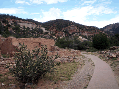
Jemez State Monument
We are a research and service division of:
Location
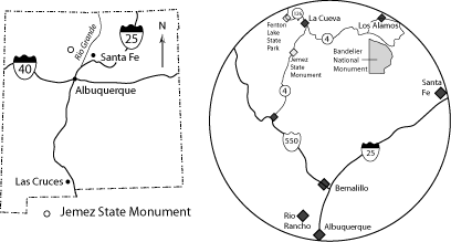
Jemez State Monument is located in the western Jemez Mountains and can be easily accessed from Albuquerque via U.S. Highway 550 at Bernalillo (Figure 1). Drive northwest on Highway 550 approximately 23 miles from the intersection of I-25 with Highway 550 in Bernalillo to San Ysidro. Turn north (right) off of Highway 550 at San Ysidro onto New Mexico State Road 4 and drive about 18 miles to the monument, which is on the east side of the road in the village of Jemez Springs. Jemez Monument can also be accessed from Los Alamos via New Mexico State Road 4.
Geology Within the Monument
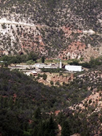
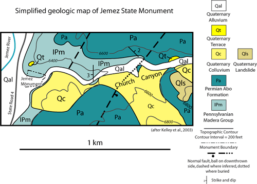
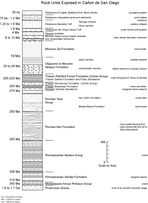
Jemez State Monument is in scenic Cañon de San Diego, which is located to the southwest of the Toledo and Valles calderas, large collapse features that formed during voluminous volcanic eruptions 1.6 and 1.25 million years ago in the Jemez Mountains. The monument lies near the mouth of Church Canyon, a tributary to the Jemez River within Cañon de San Diego. Two main rock units, the Pennsylvanian Madera Group and Permian Abo Formation, are exposed in and adjacent to the monument (Figures 3 and 4). Both limestone from the Madera Group and sandstone from the Abo Formation were incorporated into the walls of the 15th century pueblo and the 17th century Spanish mission at Jemez State Monument. Large rounded boulders of early Jemez volcanic field basalt and andesite lavas that were eroded from the high cliffs of Cañon de San Diego and carried by the Jemez River and flash floods in Church Canyon to the vicinity of the monument are also included in the walls of the structures.
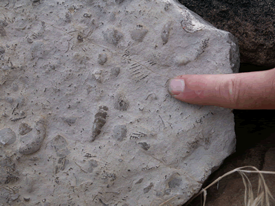
The oldest rock unit at the monument, the Pennsylvanian Madera Group, is a gray fossiliferous limestone interbedded with black shale. The Madera Group limestones and shales were deposited in a shallow ocean that covered northern New Mexico about 300 million years ago. The fossils preserved in the Madera Group include brachiopods, bryozoans, and crinoids stems (Figure 5 ; Kues, 1996). The upper contact of the Madera Group with the overlying Permian Abo Formation is transitional in this area (Figure 6). Marine limestone and shale beds are interbedded with red micaceous siltstone and arkosic sandstone deposited by rivers. These rocks indicate that the shoreline of the ocean moved back and forth across the Jemez Springs region for a time before the sea retreated toward the south approximately 290 million years ago.
Permian Abo Formation, a red siltstone interbedded with red to white arkosic sandstone, was deposited by an ancient river approximately 280-290 million years ago. This sandstone contains pebbles of quartz, quartzite, potassium feldspar, and granite. These pebbly sandstones were derived in part from the Peñasco uplift to the west of Jemez Springs, which roughly coincides with the present position of the Sierra Nacimiento, and from the Uncompaghre uplift in north-central New Mexico (Eberth and Miall, 1991). These uplifts formed during the Ancestral Rocky Mountain tectonic event that occurred during late Pennsylvanian to early Permian time (Woodward, 1987; Eberth and Miall, 1991). The Abo Formation locally contains malachite and azurite (green and blue copper minerals) in the channel sandstones; these minerals formed when copper-rich fluid moved through the sandstones long after deposition (McLemore, 1996).
A very young gravel, which was deposited by the Jemez River when it flowed across a land surface that was at an elevation approximately 50 feet above the level of the modern river, rests on the Madera Group just to the north of the monument. This gravel contains rounded pieces of obsidian from the ca. 50,000 year old Banco Bonito rhyolite flow, which was emplaced north of Battleship Rock about 4.5 miles north of Jemez Monument. Thus this gravel is younger than 50,000 years old, yielding a minimum incision rate of about 0.012 inches/year since deposition.
References
- Eberth, D.A. and Miall, A.D., 1991, Stratigraphy, sedimentology and evolution of a vertebrate-bearing braided to anastomosed fluvial system, Cutler Formation (Permian-Pennsylvanian), north-central New Mexico: Sedimentary Geology, v. 72, p. 225-252.
- Kelley, S.A., Osburn, G.R., and Kempter, K.A., 2007, Geology of Cañon de San Diego, southwestern Jemez Mountains, north-central New Mexico: New Mexico Geological Society Guidebook 58, p. 169-181.
- Kelley, S.A., Kempter, K.A., Goff, F., Rampey, M., Osburn, G.R., and Ferguson, C.A., 2003, Geology of the Jemez Springs 7.5 minute quadrangle, Sandoval County, New Mexico: New Mexico Bureau of Geology and Mineral Resources Open-file Geologic Map OF-GM 73, scale 1:24,000.
- Kues, B.S., 1996, Guide to the Late Pennsylvanian paleontology of the upper Madera Formation, Jemez Springs area, north-central New Mexico: New Mexico Geological Society Guidebook 47, p. 169-188.
- McLemore, V.T., 1996, Mineral resources in the Jemez and Nacimiento Mountains, Rio Arriba, Santa Fe, and Los Alamos Counties, New Mexico: New Mexico Geological Society Guidebook 47, p. 161-168.
- Woodward, L.A., 1987, Geology and mineral resources of Sierra Nacimiento and vicinity, New Mexico: New Mexico Bureau of Mines and Mineral Resources Memoir 42, 84 p.