


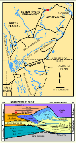
Permian Reef Complex Virtual Field Trip
Stop III-9: Queen/Seven Rivers Fm. Collapse Breccia
We are a research and service division of:
Excellent exposures of Shattuck Sandstone (Queen Fm.) on the right (see Dunham, 1972, Stop I-5; Pray and Esteban, 1977, southwest end of Stop VIII). The sandstone has broad, channel-like structures with northwest-southeast axes. Note bimodal eolian lag(?) deposits at some horizons and small adhesion ripples, suggesting that much of the sand may have been deposited on sabkhas or interdune flats. Other sedimentary structures, in lower horizons, indicate sheet-flood or ephemeral stream sedimentation; marine trace fossils are also present in basal exposures of the sandstone. Thus, there may be an upward progression of depositional environments from marine to fluvial to eolian.
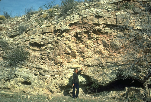
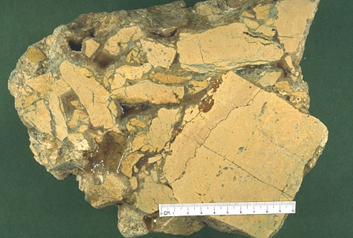
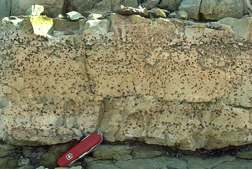
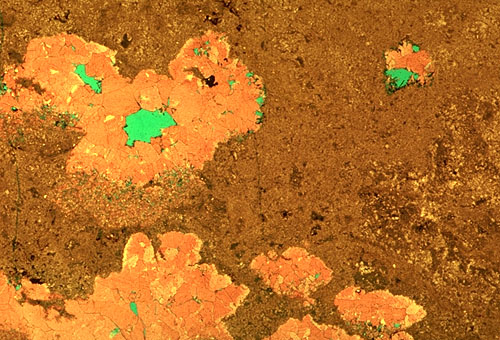
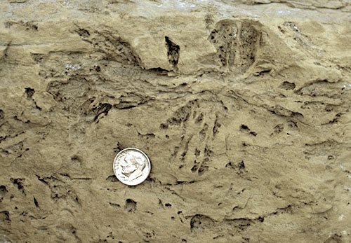
Walk uphill along the continuation of the outcrop. These medium-to thin-bedded dolomites, about 19 km (12 mi) shelfward of the Capitan scarp, are generally placed in the Seven Rivers Fm.; Sarg (1976), however, included them in the Queen Fm. Some interesting collapse breccias occur in these strata (see photo), which were included by Dunham (1972) in his "calcisphere dolomite wackestone" facies. The largest breccia occurs as an isolated pocket in a thick, light-tan dolomite bed. The breccia has large, angular clasts of dolomite with corroded and altered borders (see photo). The clasts are held in a partial matrix of microcrystalline calcite, internal sediment (green illite-kaolinite clay and quartz silt), and coarsely crystalline, blocky, late, sparry calcite cement. Considerable remnant porosity also is present in the breccia zones. The presence of the greenish clays and abundant evaporite crystal molds (see photo) indicate that these breccias are probably the result of interstratal evaporite dissolution. The presence of some zones with calcitic nodules with geopetal collapse features associated with evaporite removal (see photo) and other zones with gypsum pseudomorphs (see photo) reinforces that interpretation.
© Peter A. Scholle, 1999
© Peter A. Scholle, 1999
© Peter A. Scholle, 1999
© Peter A. Scholle, 1999
© Peter A. Scholle, 1999
Pray and Esteban (1977) argued for a modern karstic origin for these features; Dunham (1972) postulated a Permian origin, presumably related to weathering and dissolution of evaporite minerals during pluvial intervals. Note the abundant evidence of associated evaporite (mainly gypsum) crystal casts in these dolomites and decide for yourself when dissolution took place.
Return to Dark Canyon-Sitting Bull Falls-Rocky Arroyo Roadlog