Geologic Tour of the Basin and Range Province
Contents:
Tour site types:
•State Parks
•Federal Parks
•Other Features
(Click map to hide/show the physiographic province overlay.)
Brief Description
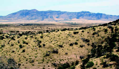
The semi-arid Basin and Range province in the southwestern corner of New Mexico is part of a larger geologic feature of the same name that also covers portions of west Texas, southern Arizona, western Utah, southern Idaho, eastern California, and most of Nevada. The Basin and Range extends into northern Mexico, as well. The Basin and Range is characterized by northerly to northwesterly-trending narrow, rugged mountain ranges separated by broad basins. This topography results from extension of the Earth's crust. Although the Gila River crosses the northwest part of the area, many of the streams have no outlet to the ocean, so water collects in the broad basins, forming large lakes and playas during wet years.
Mining is an important industry in southwestern New Mexico. Several of these tours in the Basin and Range province are focused on mines, minerals, or mining history.

Dave McCraw
References
- Lawton, T.F., McMillan, N.J., and McLemore, V.T., 2000, Southwest passage: A trip through the Phanerozoic: New Mexico Geological Society Guidebook, 51st Field Conference, 281 p..


