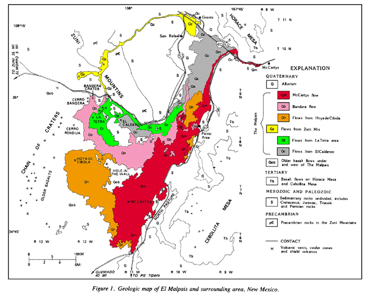
Geologic Map of the Zuni-Bandera Volcanic Field
This is a geologic map of the Zuni-Bandera volcanic field. The map is oriented north-south, and is about 100 km (60 miles) along the north-south axis. The lava flows in this image are represented by the colored areas on the map which cover much of the central and lower left part of the map. Vents are shown as black stars, and are labelled for most colored flows. The age of the lava flows can be determined by the scale, with the younger flows being red, and the oldest grey. To see a very high resolution version of this image, click here. You can also get a PDF file of the map for printing by clicking here.


