
Bandera Crater and the "Chain of Craters"
The following images were taken as part of the 2000 Rockin' around New Mexico meeting, held in Grants, New Mexico. The captions and locations were prepared by participants on the field trip. For an enlarged version of any image, click on the small version of the image.
The Bandera Crater, located near Grants, New Mexico, is a good example of a cinder cone. In fact, Bandera Crater consists of two coalesced cinder cones. Bandera Crater probably produced fire fountaining and spattering during eruption. The Bandera Crater eruption produced a voluminous lava flow, consisting of both aa and pahoehoe lava flows. The extent of the Bandera Crater flow can be seen on the geologic map as well as on the satellite image. While walking up Bandera Crater, you have a good opportunity to view the "Chain of Craters", a set of cinder cones aligned along a zone of crustal weakness.
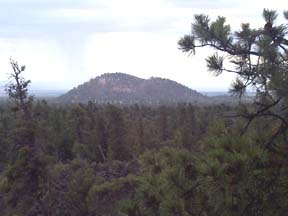 |
GPS LOCATION: N34° 59' 54.1" W108° 05'4.9" |
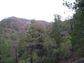 |
GPS LOCATION: N34° 59.760'
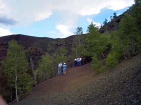
W108° 5.141' As long as the vent continued to fountain out cinder, the cone continued to grow. Eventually, the composition of the lava may have changed slightly (became less volatile) thus changing the nature of the eruption. At this point the crater began to fill with lava, creating a lava lake. The lava lake was not contained within the crater for long. Soon the lava breached the crater's lowest wall (the southern portion) and flowed through to create the voluminous lava flow spreading out and away from Bandera Crater. As this lava flowed, it created a huge lava tube, the evidence of which we see as the deep gully in the bottom of this picture. To the left of the picture is a thick basalt flow located just below the western portion of the crater rim. This flow marks where the surface of the original basalt flow (the one which formed the roof of the lava tube nearest the crater) was located with respect to the cinder cone. Eventually the flow was in the gigantic tube subsided and the roof, no longer gaining support from the flow, collapsed. |
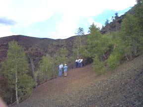 |
GPS LOCATION: N34° 59'
45.6" W108° 5' 10.6" Halfway down the slope is a ledge of a basalt lava flow, which occurred after the cinder cone, was formed. Vegetation: Ponderosa pine, piñon, and juniper |
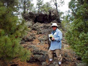 |
|
 |
GPS LOCATION: N34° 59'
45.3" W108° 05' 10.4" CAPTION: This photo shows bedded cinders. Within the population of cinders, the larger and heavier are the first to fall and smaller ones fall later, leading to graded bedding of these pyroclastic fragments. |
 |
GPS LOCATION: N34° 59'
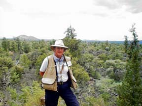
45.3" W108° 05' 10.4" CAPTION: This photo shows example of volcanic cinders. Rocks are vesicular due to expanding gases erupting. Dark color due to minerals dominated by Fe and Mg. No crystals seen because of rapid cooling. Sizes of most pyroclastics in picture are ranging from lapilli (2-64mm) to bomb size (764mm). Gases (volatiles) expand in magma as it rises to the earth's surface via conduits. |
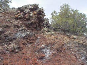 |
LOCATION: near previous photo CAPTION: This photo shows "welded spatter". During some parts of cinder cone eruption, the cinders are still partially molten when the hit the ground. In this case, they can stick together, or weld after deposition. Cinder cones are typically made up of some welded, and some non-welded layers. Welded or non-welded cinders can be either red or black, depending on the degree to which iron (Fe) in the cinders has been oxidized. |
 |
GPS LOCATION: N34° 59' 42.2"
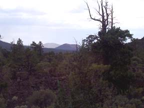
W108° 5' 7.9" CAPTION: From Bandera Crater, a number of other cinder cones are visible. This photo shows the two nearby cones. These cinder cones make up a feature called the "Chain of Craters", that is well-marked on the geologic map. The alignment of these cones would be cause by a linear weakness in the earth's crust. |
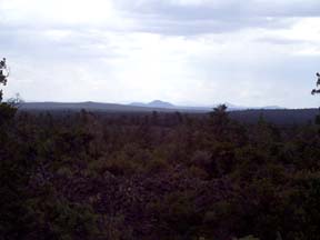 |
GPS LOCATION: N34° 59'
42.2" W108° 5' 7.9" CAPTION: This photo shows a line of cinder cones looking south from Bandera Crater. In the left of the picture is a cinder cone and to the right of the picture is a more distant cinder cone. Further to the right but not in the picture are several very close cinder cones. In the far distance are several more cinder cones stretching further away with about 15 different cones visible. |


