


Pahoehoe features of the McCartys Flow
We are a research and service division of:
The following images were taken as part of the 2000 Rockin' around New Mexico meeting, held in Grants, New Mexico. The captions and locations were prepared by participants on the field trip. For an enlarged version of any image, click on the small version of the image.
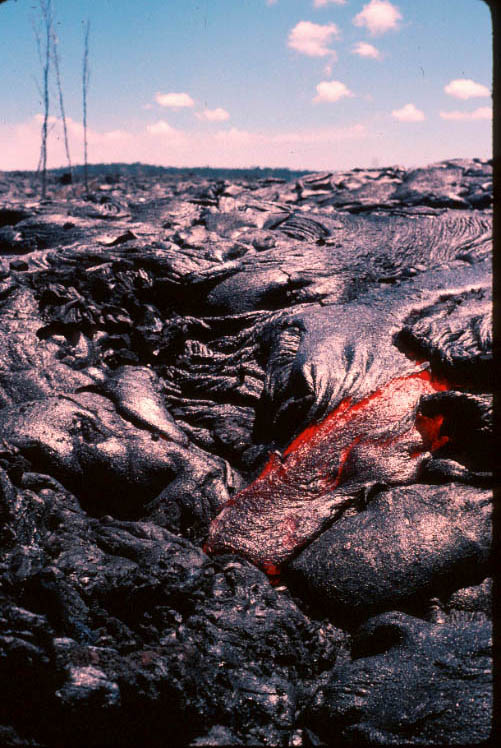
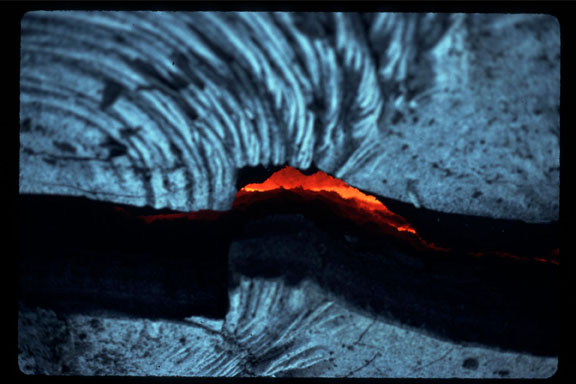
Pahoehoe lava flows form from very fluid basaltic lava, and have characteristic smooth, billowing, or ropey crusts of quenched glass over more crystalline flow interiors (Williams and McBirney, 1979). Many of the features observed in pahoehoe lava flows are related a process whereby hot, fluid lava flows under and drags, or inflates and splits, the partially cooled crust. Ropes are formed by the cooled surface being dragged, and deformed by hotter, flowing lava. Fissures and tumescences can be formed by hot lava flowing under, inflating and cracking a cool, brittle crust. Squeeze-ups can be formed when hot lava is squeezed up through a small fissure, or hole in the cool crust. The following photos illustrate a number of features that can be observed on the McCartys lava flow near Grants, NM. For images of active pahoehoe flows, click here or here.
 |
GPS LOCATION: N34° 55.941' W107°
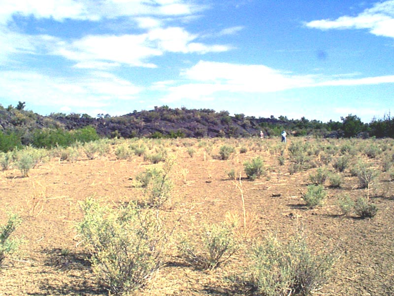
50.507' CAPTION: This is an overview picture of McCartys flow front with Joe in the picture for scale. McCarty flow approximately 3,000 years old, and is mainly composed of pahoehoe lava. The height of ridge is approximately 15' to 20'. Edge of pressure (fissure) ridge. Local vegetation is salt bush. |
 |
GPS LOCATION: N34° 55.954' W107°
50.523'
|
 |
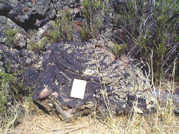
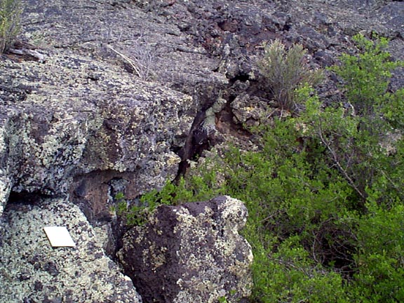
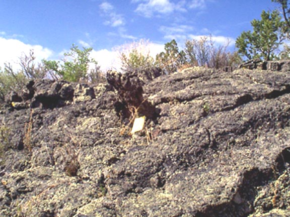
GPS LOCATION: N34° 55.953'
W107° 50.524' A closer examination displayed a black outer layer and an inner tan and gray core full of air bubbles. There were also tiny holes and fissures on the outer surfaces. The fissures did not show much glassiness. A few tiny crystals were observed on the glassy crust using a magnifying lens. In a tiny crevice of the glassy crust, a bluish, purple sheen was observed. Apache plume, New Mexico plumes and blue gramma grass were observed growing next to the frontal flow. |
 |
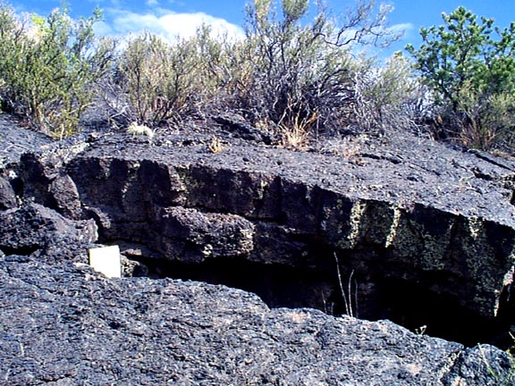
GPS LOCATION: N34° 55.958'
W107° 50.496' CAPTION: Upon first sight, the collapsed pit is not noticeable due to New Mexico Olive in front. Further inspection showed how the top of the lava flow has collapsed to the soil level below. The layers from subsequent flows are apparent in the collapse face. If the Olive were not present, the pit would appear as a cave in the flow face. The thickness of the original lava flow surface was thin here, probably one foot or less. As the thin lava crust, probably overlying a lava tube, cooled, is could have fractured and collapsed. Once the initial collapse occurred larger sections are more open to weathering causing fracturing and collapse of these sections, also. This collapse feature is similar to the opening to many lava tubes. |
 |
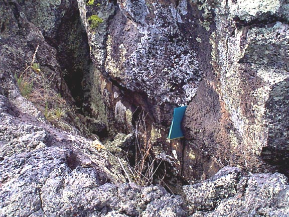
GPS LOCATION: N34° 55.984' W107°
50.493 CAPTION: This picture shows a fissure, a place in this pahoehoe lava flow where magma broke through the already hardened surface. The surface of the flow at this point is relatively smooth, but the fissure itself is cracked and jagged. Cacti and other plants are growing on the surface of the flow. Lichen, cacti, and other plants are growing inside the fissure. For a view of an active fissure, click here. |
 |
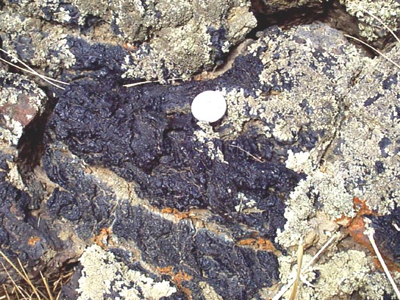
GPS LOCATION: N34° 55.935', W107° 50.475' CAPTION: This photo shows the details of the inner part of a fissure in the surface of the lava. This part of the lava flow pressure ridge shows a central rupture, or fissure. The orientation of the fissure was estimated to be N 45° W. The fissure's opening was about 4'-0" wide and ranged from 4'-0" to 7'-0" deep, and was an estimated 25+ feet in length. Five (5) flow strata were observed on the ruptured wall. Because both of the ruptured walls displayed a surface-to-depth breaking pattern that was as smooth as lava breaks go, I believe that differential cooling of the pressure ridge can be ruled out as the engine for this fissure. A possible explanation for the formation of the fissure would be inflation of the cooled surface by underlying hot lava. |
 |
GPS LOCATION: N34° 55.984'
W107° 50.486' CAPTION: This picture illustrates a small fissure that formed in the surface of an active flow. This would be a smaller example of the fissure shown in the previous picture. One possible mechanism that could have formed this fissure would have been if hot lava caused inflation of an already-cool and brittle crust of cold lava. The inflation could have caused the splitting, or fissuring, to occur. Ropes on the two sides of the fissure match perfectly, indicating that no lateral movement occurred during fissuring. The next two photos show other view of this fissure. |
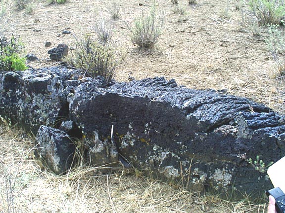 |
GPS LOCATION: N34° 55.984'
W107° 50.486' CAPTION: This picture shows a side view of the fissure shown in the above picture. The pahoehoe ropes on the upper surface are well displayed. |
 |
GPS LOCATION: N34° 55.984' W107° 50.486' |
 |
GPS LOCATION: N34° 55.935',
W107° 50.475' CAPTION: This photo illustrated a "squeeze up", where hot lava is pushed out through a small fissure in a cooled lava crust. The squeeze up is a bit difficult to see in this photo, but is right above the notebook. The squeeze-up is protruding out, and leaning towards, the viewer, and can be seen better in the larger verion of the photo (click on the small version to get there). The SWside of the S-U/wall contact was free of lava debris and was easily observed; however, broken wall material did not permit the NE S-U/wall contact zone to be viewed. Striae on both sides of the McCarty squeeze up were prominent and very well formed, and along part of the SW wall zone, it appeared that some of the earlier solidified striae-causing lava was still in place. The lava source for this squeeze-up was probably an underlying, yet-to-be located lava tube. |