


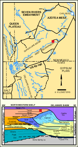
Permian Reef Complex Virtual Field Trip
Stop I-3: Carlsbad Caverns and Tansill Fm. Tepee
We are a research and service division of:
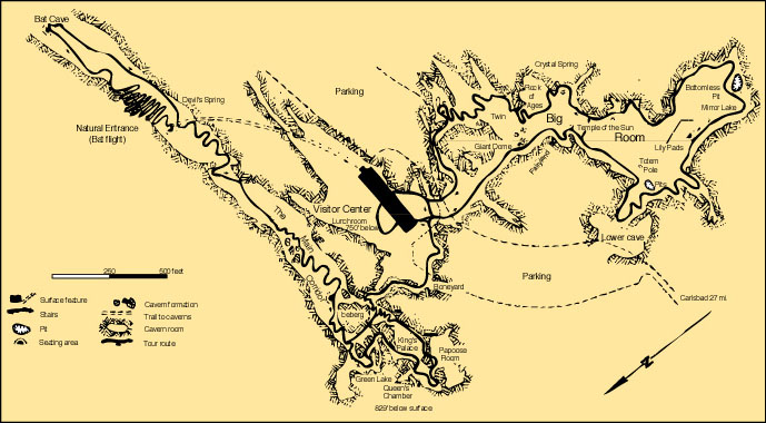
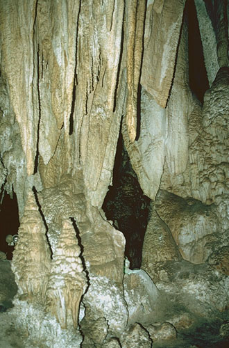
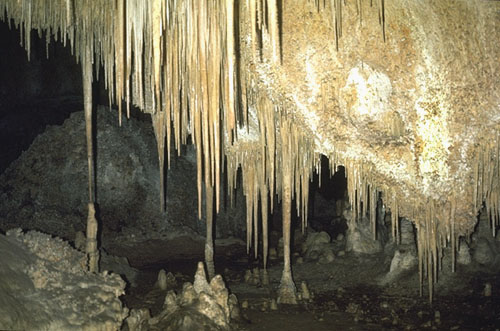
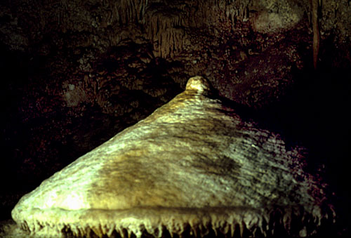
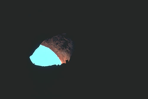
Cave entrance parking lot. We will do the complete walking tour of Carlsbad Caverns (see map below) — the Roswell Geological Society 1964 field trip guidebook provides a trail log of the caverns (Sanchez, 1964). The cave is the largest (but by no means the longest) cavern system in the world and has spectacular speleothems (draperies, stalactites & stalagmites, and various body parts). The cave is developed primarily in the fractured reef and forereef Capitan Limestone, but the entrance (see photo) and all of the upper level are in the back-reef dolomites of the Tansill and Yates Fms. The lowest parts of the cave extend down to a level approximately 260 m (850 ft) below the entrance. These deep parts of the cave are cut in the lower part of the reef as well as steeply-dipping fore-reef talus of the Capitan Formation. You should be able to see this fore-reef bedding on your circuit of the Big Room near the "Bottomless Pit" (or look back down the trail when you see the sign for "Bat Guano"). This deep level of dissolution is presumably related to the regional groundwater discharge surface in the Pecos valley to the northeast.
© Peter A. Scholle, 1999
© Peter A. Scholle, 1999
© Peter A. Scholle, 1999
© Peter A. Scholle, 1999
The history of development of the cave is extensively described by Jagnow (1979), Hill (1987), and DuChene and McLean (1989). The location and orientation of the Capitan reef and its early fracture system have controlled, to a large degree, the geometry of the local cave systems. Pliocene-Pleistocene and earlier uplift allowed percolation of phreatic groundwater through the joint system and eventual excavation of the caverns. H2S, from the bacterial reduction of Permian sulfates in the presence of hydrocarbons, is common in groundwaters of the area and likely was important in forming acids which dissolved many of the caves in this region. The subsequent vadose history of the cave led to introduction (and later partial removal) of clay, silt, sand, and gypsum fills as well as calcitic (and even dolomitic) speleothems. Convective air circulation (Queen, 1981; Hill, 1987) may be responsible for much of the irregular distribution of precipitated calcite "popcorn" on the walls and formations of the cave (such as the Lion's Tail). With the exception of air circulation, the cave is largely inactive today except for some areas in the lowest cave levels.
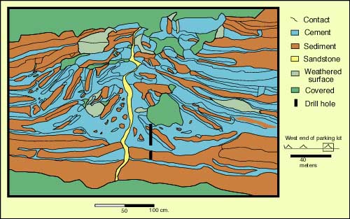
The outcrops at the southwest end of the parking lot provide excellent exposures of tepee structures, sheet cracks, and pisolitic sediments of the Tansill Fm. which we will visit if time permits. Use the description from Stop I-4 and the tepee diagram nearby to guide your observations.
Return down Walnut Canyon.