


Permian Reef Complex Virtual Field Trip
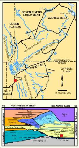
Stop II-3: Brushy Canyon Fm. – Basinal Fan-Channel
We are a research and service division of:
BE CAREFUL TRAFFIC IS ESPECIALLY HAZARDOUS AT THIS OUTCROP!
© Peter A. Scholle, 1999
© Peter A. Scholle, 1999
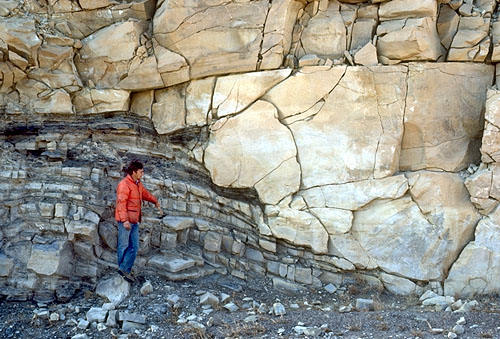
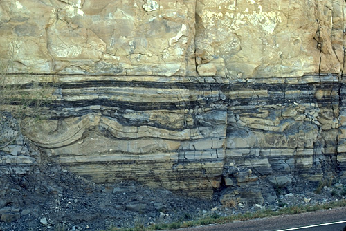
An exposure of basinal Brushy Canyon Formation, the lowest unit in the Delaware Mountain Group. The feature of special interest at this locality is the exposed margin of a submarine channel (see photo). Such channels are common in this formation and, at least in this area, generally trend northwest-southeast, that is, perpendicular to the shelf margin. At this locality, we can see dark-colored, graded, relatively fine-grained sandstones, siltstones, and shales in thin beds with some soft-sediment deformation features (see photo). These beds are abruptly cut by a uniform, thick-bedded, sandstone-filled channel. Both types of sediments were clearly soft, even fluid, at the time of deposition, as shown by the fact that the channel margins are extensively deformed by sand injection. Channel cutting and filling most likely were separate events, perhaps separated by considerable time. That is, the channel was cut, acted as a sediment conduit for some time, and then was filled and abandoned. Evidence for this comes from the commonly observed shale drapes which lie between the cut channels and the multiple episodes of later sand fillings (Harms, 1974; Harms and Williamson, 1988).
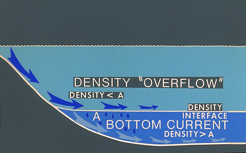
Hayes (1964), Jacka et al. (1968), Payne (1979), Berg (1979), Williamson (1977 and 1979), Bashman (1996) and other authors have interpreted these or similar deposits as part of larger submarine fans and/or as part of a basinally restricted deep-water wedge of siliciclastic sediment (Rossen, 1985; Rossen and Sarg, 1988). The graded, finer-grained sediments are considered to be interchannel or overbank turbidity-current deposits. The cut and fill, massive, amalgamated sandstones are interpreted as part of an anastomosing system of fan channels, eventually abandoned or filled by multiple episodes of sand transport, possibly by grain flows (Watson, 1979). Harms (1974), on the other hand, proposed that the finer-grained sediments were deposited by density overflows (see diagram) which dropped suspended sediments as they moved out over density interfaces within the water column rather than at the sediment-water interface. The channels were cut, according to Harms, by saline and cold density currents (rather than turbidity currents) which formed on the shelf. The sand fillings of the channels were also laid down by density currents.
In either case, these large (commonly more than 0.8 km/1-2 mi wide and 15-30 m / 50-100 ft thick) channelized sandstones, surrounded by lower permeability siltstones and shales, represent significant potential stratigraphic traps. This is especially true because of the close spatial association of these sandstones and the potential basinal source rocks. Indeed, exploration efforts to date have located more than 100 oil and gas fields which produce from channel-sandstone reservoirs of the Delaware Mountain Group, primarily (but not exclusively) from the Bell Canyon Formation (see Table 3).