Virtual Geologic Field Trips to the Permian Reef Complex, Guadalupe and Delaware Mountains, New Mexico & West Texas
— Geologic Road Log: McKittrick Canyon (Guadalupe Mtns. National Park)
Stops:

Introduction
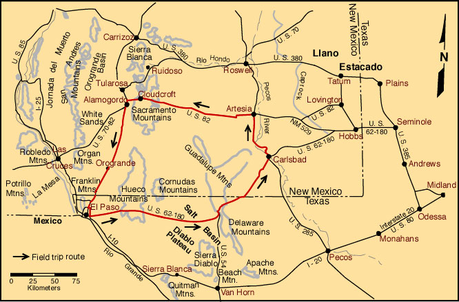
This guide to the geology from Whites City to Carlsbad Caverns (Walnut Canyon) was put together for AAPG Field Seminars run from the 1980's through the mid-1990's. Some elements have been revised since then; others are in the process of being revised. So please accept the fact that not all parts of this log are fully up-to-date. Clicking on references shown in blue takes you to the appropriate bibliography; however, you need to scroll to the correct citation. The descriptions of the main field trip localities also are found in separate files but are easily accessed by clicking on the locality name. This is a side trip from the main field trip roadlog to U.S. 62-180 from El Paso to Carlsbad.
| Mileage | Cumul. Mileage | Location Description |
|---|---|---|
| 0.0 | 0.0 | Junction of U. S. Highway 62-180 with paved road to McKittrick Canyon day-use area (mileage 113.8 on El Paso-Carlsbad road log). Take McKittrick Canyon road. Most of this new road is cut in the McCombs to Rader interval of the Bell Canyon Fm. The cliffs on the right (north) are capped by the Lamar Limestone Member. |
| 0.4 | 0.4 | The view ahead is directly into the steeply dipping Capitan fore-reef talus deposits. |
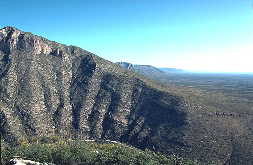
| 1.6 | 2.0 | Junction with side road (locked gate) which leads to Wallace Pratt's former home "Ship on the Desert". The view to the northwest shows the exhumed Delaware basin margin, largely stripped of its evaporite filling. The reef-massif is characterized by an apparent lack of bedding and a strongly developed vertical joint pattern which trends parallel to the reef front. These were penecontemporaneous growth faults probably produced by compaction of the 450-600 m (1,500-2,000 ft) of largely unconsolidated reef talus over which the reef was prograding. The penecontemporaneous formation (and filling) of the joints is shown by the fact that locally one finds specialized Permian faunas lining fracture walls. The joints are also filled with submarine calcite cement crusts, Permian siltstones, soil crusts, and other materials. Steeply dipping fore-reef deposits are visible down-slope from the reef and these form a smooth transition to the nearly flat-lying toe-of-slope and basinal deposits seen at the base of the escarpment. |
| 2.0 | 4.0 | Outcrops of massive, fine-grained, toe-of-slope deposits of the Lamar Limestone on the left. Large-scale lenticular bedding is clearly visible. Although largely composed of micritic limestone, these deposits contain a significant reefal fauna. Thus, they were originally interpreted as bioherms formed in deep water (depths probably in excess of 500 m; 1,600 ft)(Newell et al., 1953). However, recent studies of the Florida Straits and similar areas have shown that such deposits can be produced by a combination of down-slope reworking of reefal debris, along-slope transport and deposition by contour currents, and submarine cementation (Mullins et al., 1981; Neumann and Ball, 1970; Neumann et al., 1977). Thus, these lenticular deposits may be analogous to the "lithoherms" of the Florida-Bahamas region. |
| 0.3 | 4.3 |

© Peter A. Scholle, 1999
STOP II-1. McKittrick Canyon Visitor's Center. This stop is entirely on National Park land and collecting is not permitted. We will be taking a short walk down the trail on the canyon floor and will then head up the Permian Reef trail, a hike that will take about 3-5 hours. Be sure to bring sunscreen and plenty of liquids to drink. |


